
 パソコ
やあ!パソコだよ!わからないことがあればコメントで教えてね!
“If we go to Hakone, I want to walk the old road.” That one line was all it took to set the plan in motion. September 27–28, 2024: one night in Hakone, Kanagawa, reached by Romancecar express from Shinjuku. Instead of the ropeway or the pirate ship cruise on Lake Ashi, the main attraction for this trip was walking an actual stretch of the Old Tokaido Road—the stone-paved path that has remained almost unchanged since the Edo period.
Quick Facts
- Dates: September 27–28, 2024 (1 night, 2 days)
- Location: Hakone-machi, Ashigarashimo-gun, Kanagawa
- Travel style: Hiking the Old Road + onsen accommodation
- Hiking route: Hatajuku → Hakone Old Road → Motohakone (approx. 3 hours)
- Accommodation: Hotel Biore, dinner included (French course)
- Estimated cost (per person): Transport (Shinjuku ↔ Hakone-Yumoto round trip, incl. Romancecar surcharge) ¥3,700 / Accommodation (2 meals) ¥28,000 / Miscellaneous ¥2,000 → Total approx. ¥33,700 (US$225 at ¥150=US$1)
- Weather: Overcast (late September, cool temperatures)
Day 1: Hiking the Hakone Old Road from Hatajuku to Motohakone
Getting to Hatajuku
We arrived at Hakone-Yumoto just after noon and transferred to the Hakone Tozan Bus, heading to Hatajuku—the starting point for the Old Road hike. Hatajuku is a small post town at the midpoint of the Hakone Old Road, surrounded by a quiet rural settlement. From here, it’s a three-hour walk along Edo-era stone pavement to Motohakone.
 ▲ Start of the Hakone Old Road hike. Near the entrance to the Sukumo River Nature Trail, deep green forest
 ▲ A mountain path heading toward the old road from Hatajuku. Walking through a quiet forest enclosed by trees
 ▲ Moss-covered stone pavement and dappled light through the trees. The feel of the old Tokaido Road
 ▲ Stone pavement continues. The ground looks wet—possibly after rain—so we walk carefully to avoid slipping
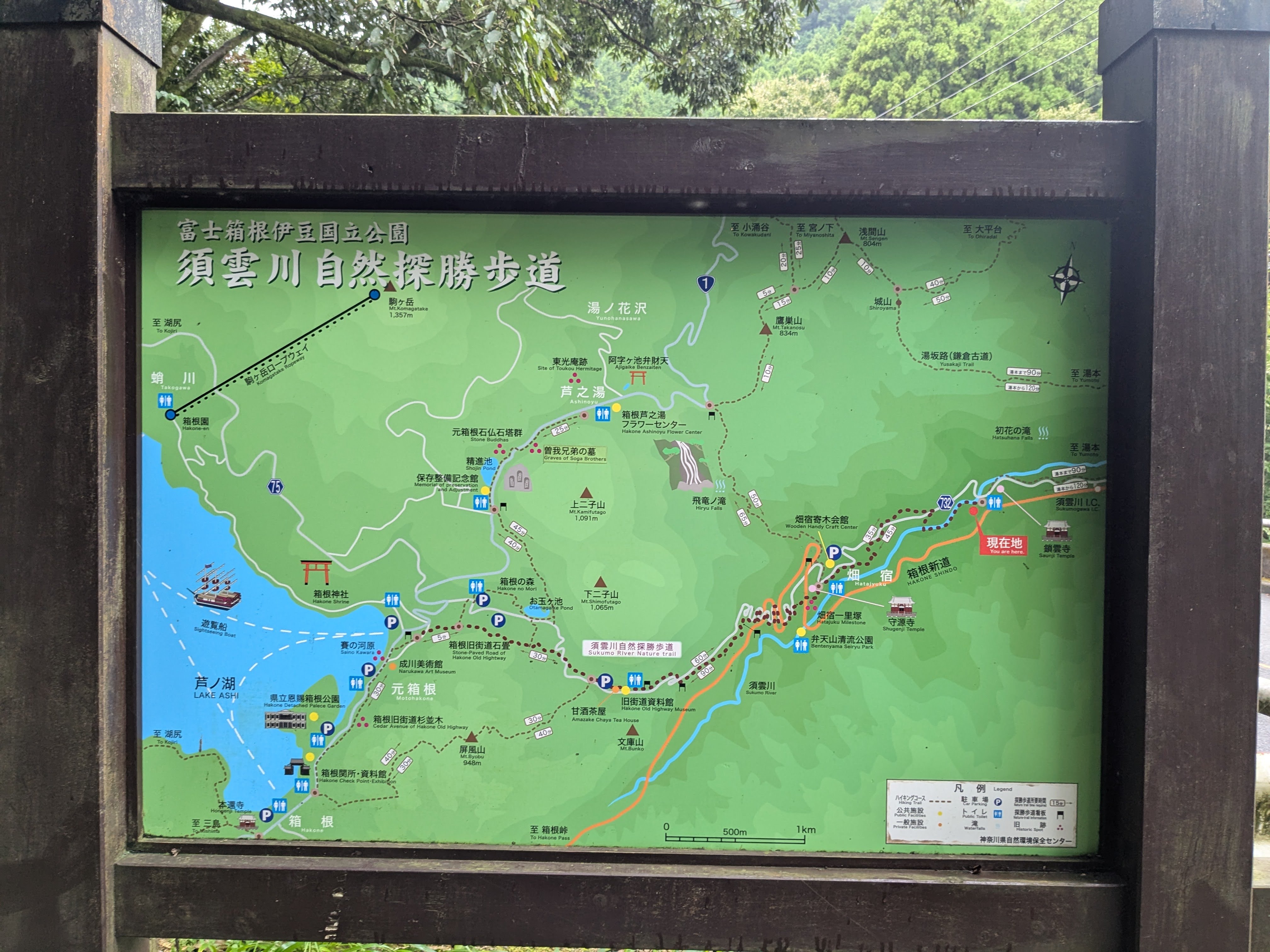
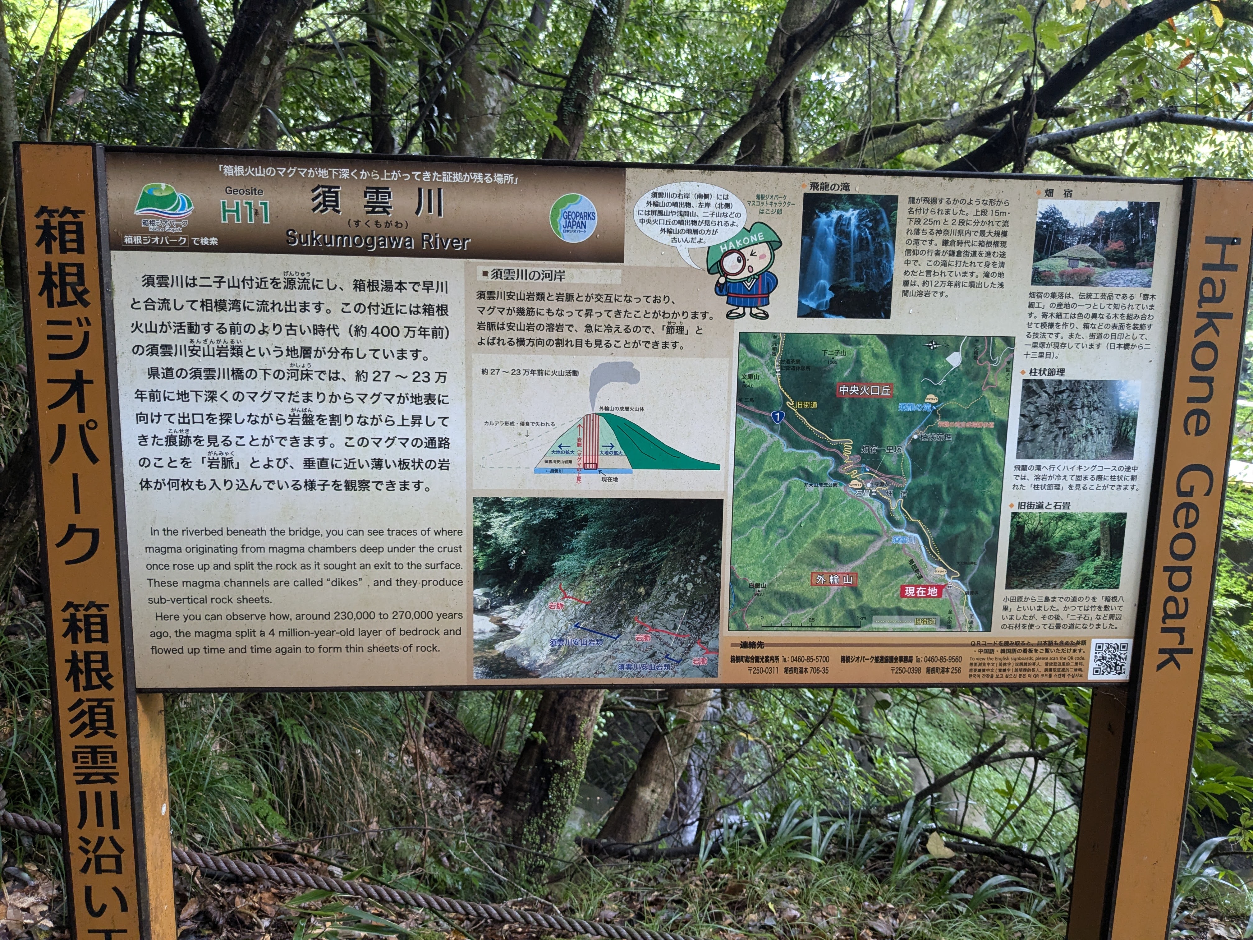
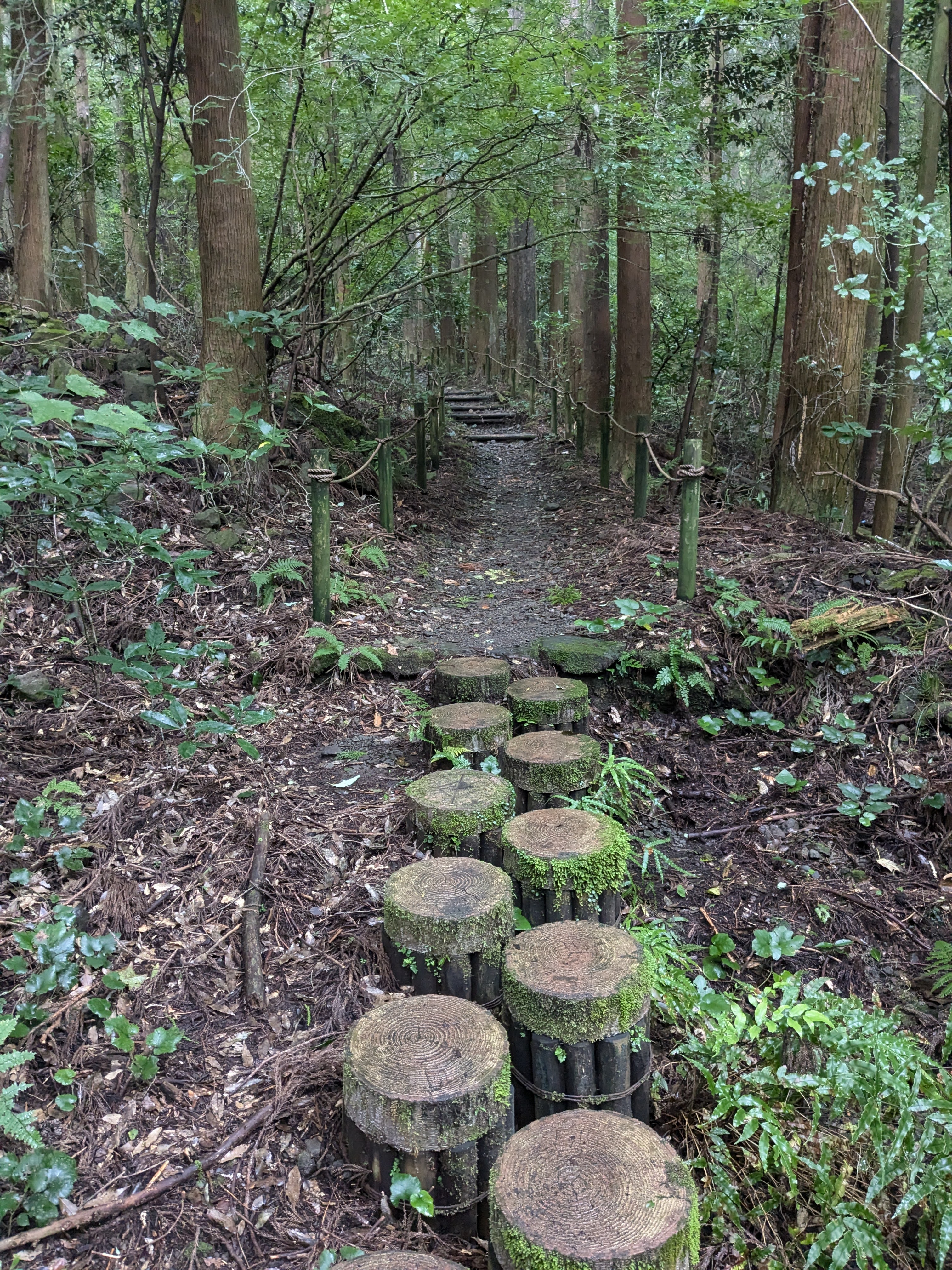 ▲ Signboard for the Sukumo River Nature Trail. This is a hiking course inside Fuji-Hakone-Izu National Park
 ▲ Stone steps flanked by bamboo and cedar. The uneven steps put a surprising strain on the knees
Tracing the Japan Heritage “Hakone Old Road”
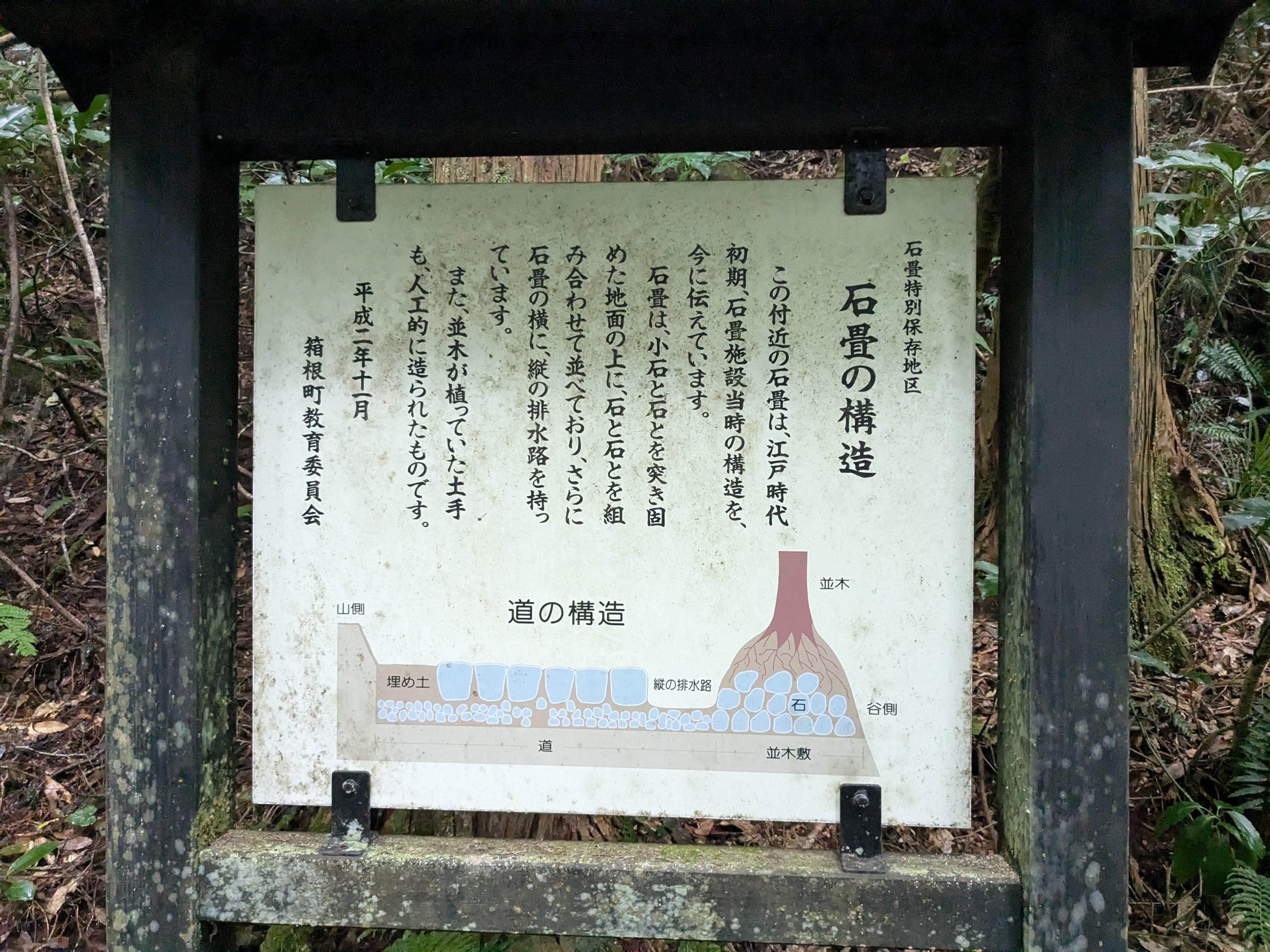
After passing through the Sukumo River Nature Trail, we entered the main stretch of the Old Road. Explanatory signs—bearing the “Japan Heritage” and “Hakone Town” markings—appeared one after another, each naming a different slope along the way.
 ▲ Mossy stone steps with iron-pipe handrails. The steep climb continues, but bamboo overhead keeps it cool
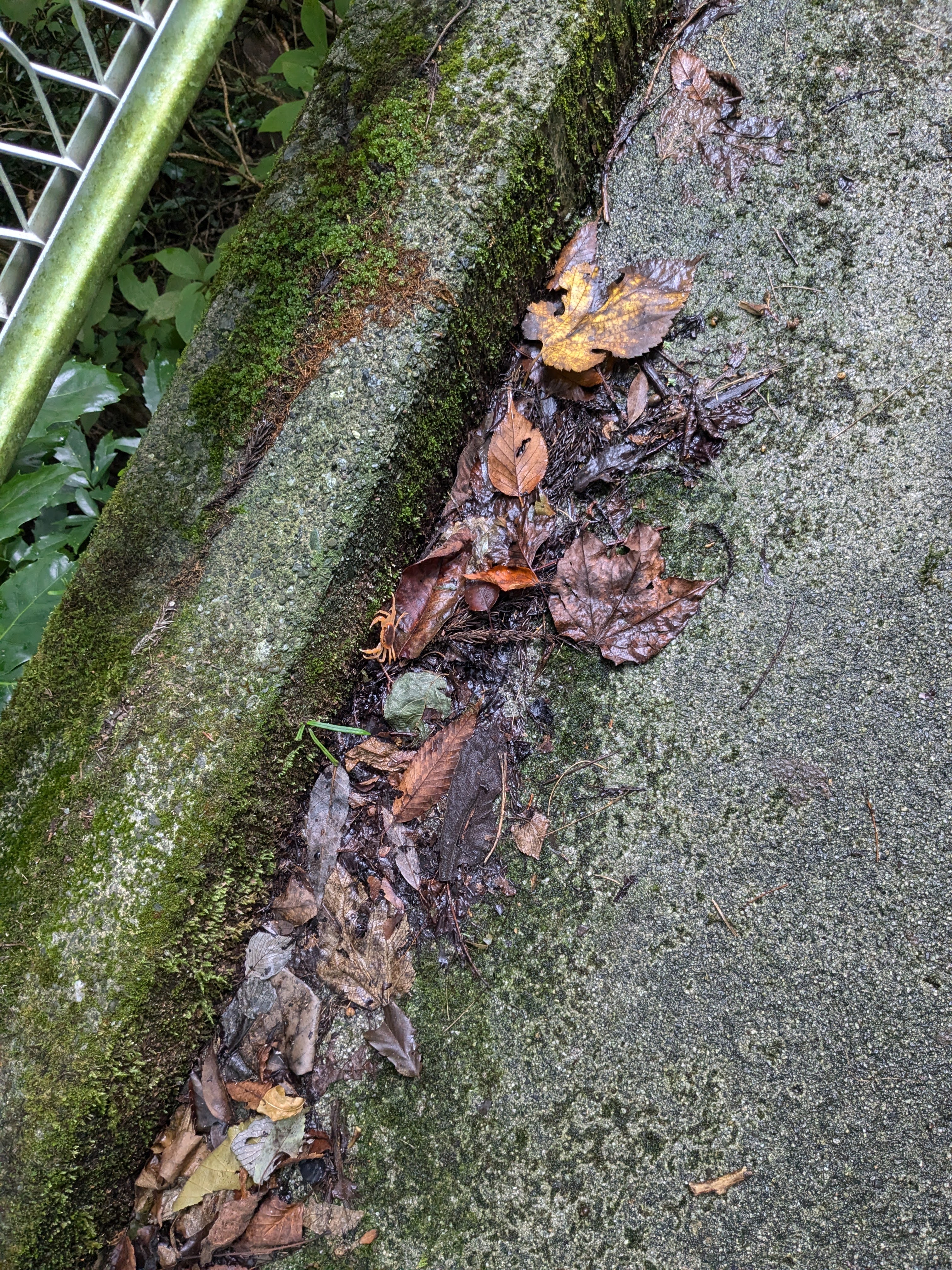 ▲ Stone pavement through the forest. Fallen leaves cover the path, and some stones are muddy underfoot
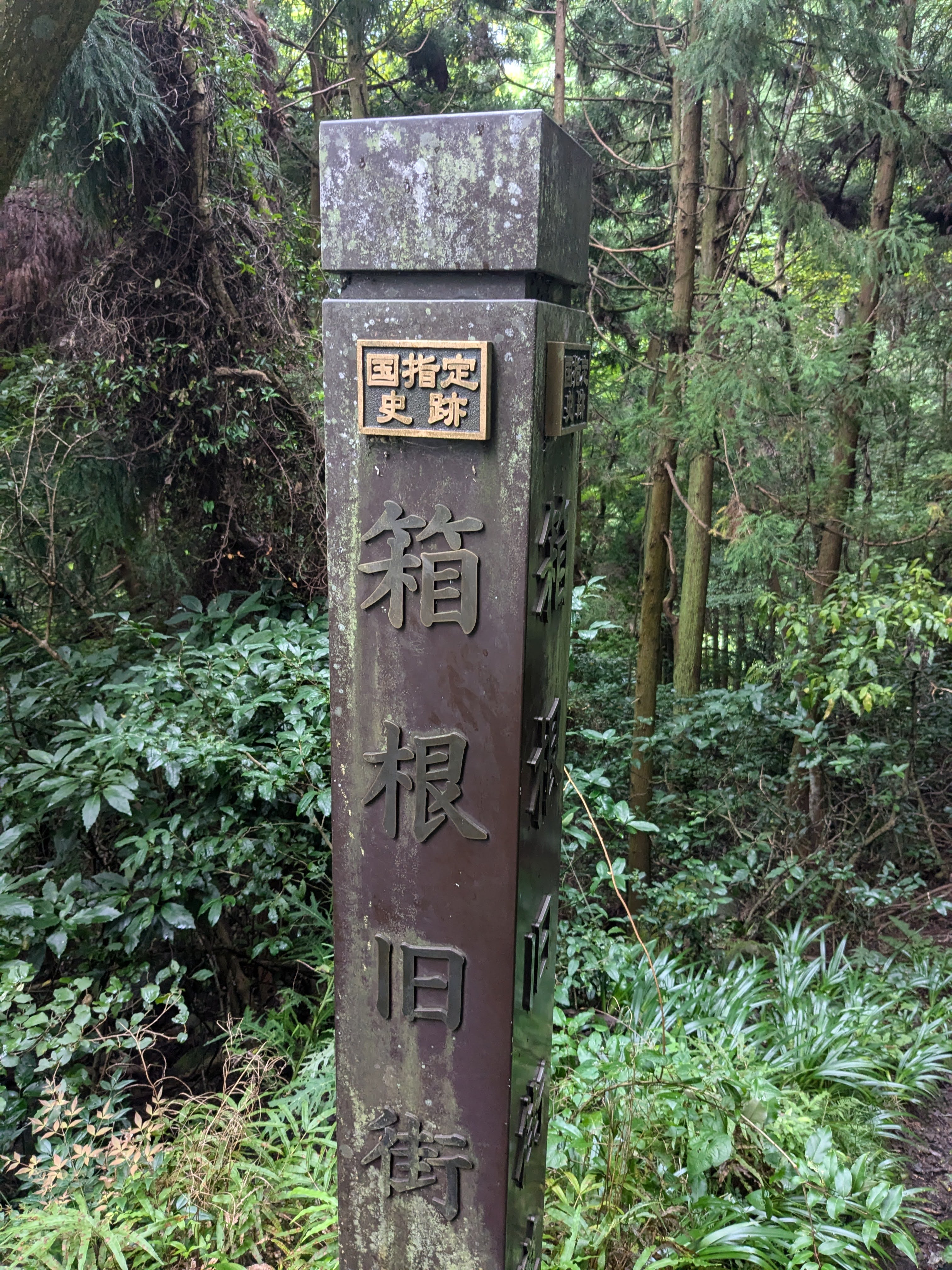 ▲ A directional sign on the Old Road showing distances and times to the next points of interest
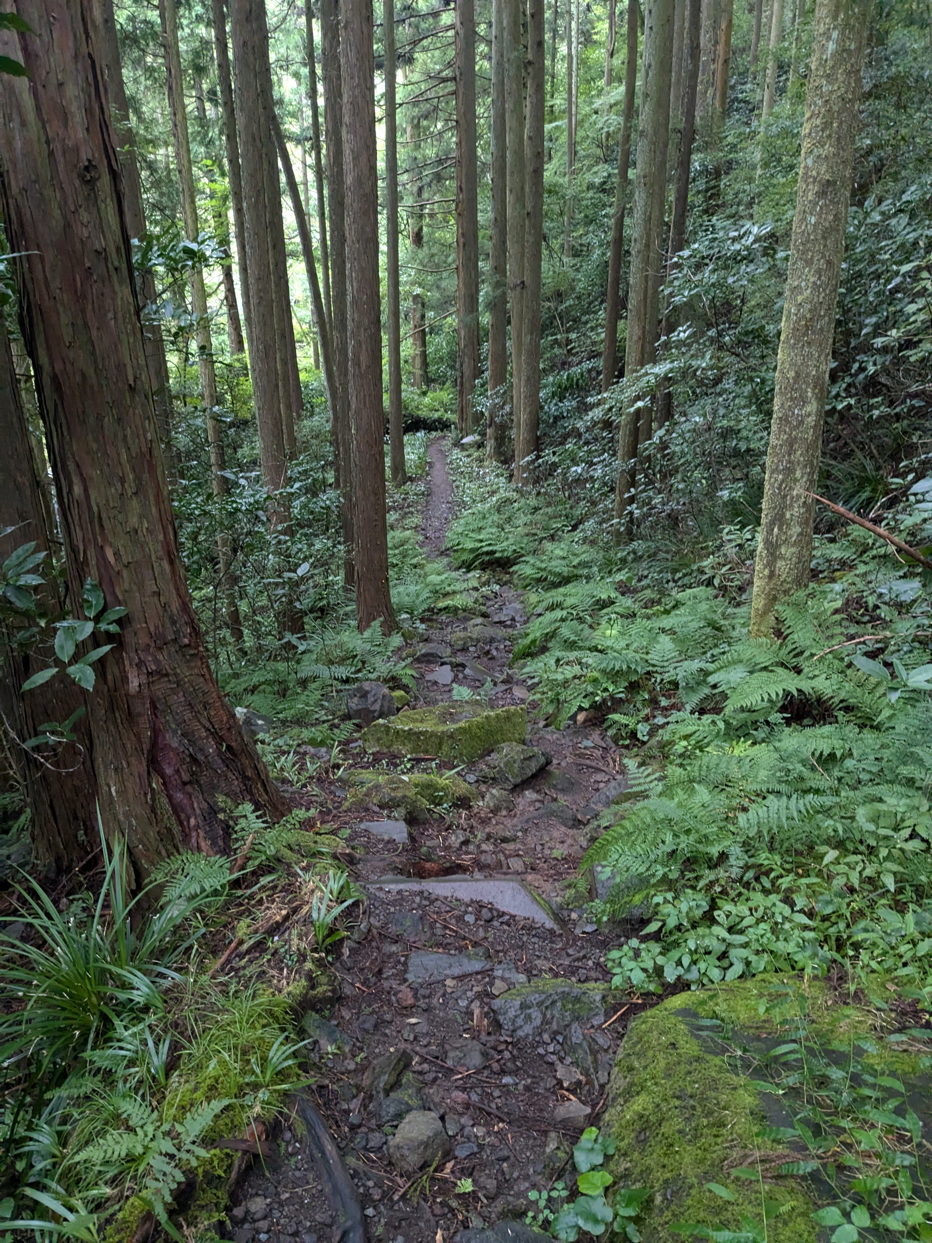 ▲ A mountain path mixing bamboo and cedar. As we walk on, the noise of the city disappears entirely
 ▲ A steep stone-paved slope. Trees press in on both sides, forming a tunnel-like green arch
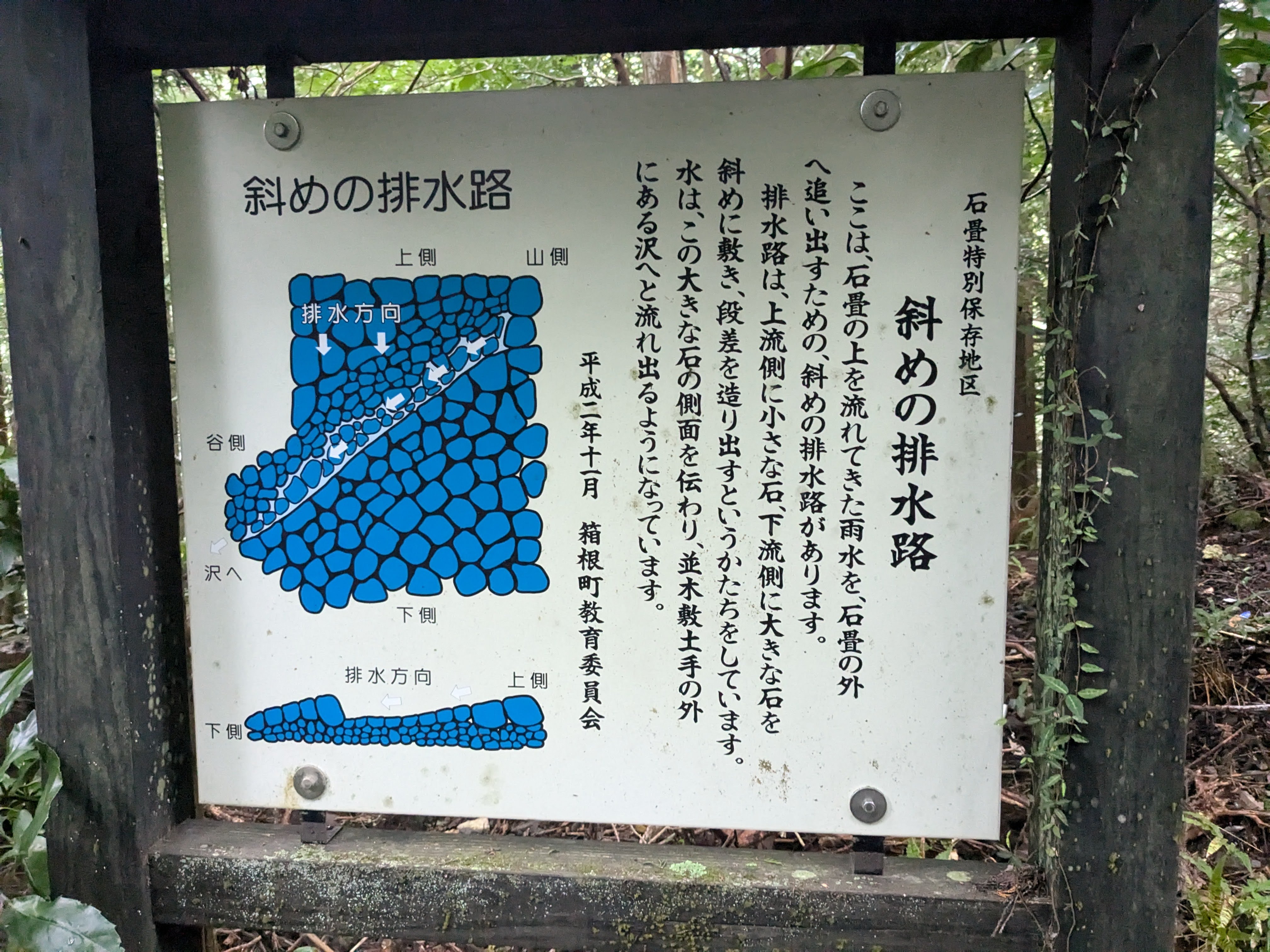 ▲ A stone monument and explanatory board on the Old Road. The air of travellers from centuries past lingers
Past the Amazake-Chaya Area and into the Named Slopes
About 90 minutes into the hike, we passed the section near the historic Amazake-Chaya teahouse and entered the stretch of famous named slopes.
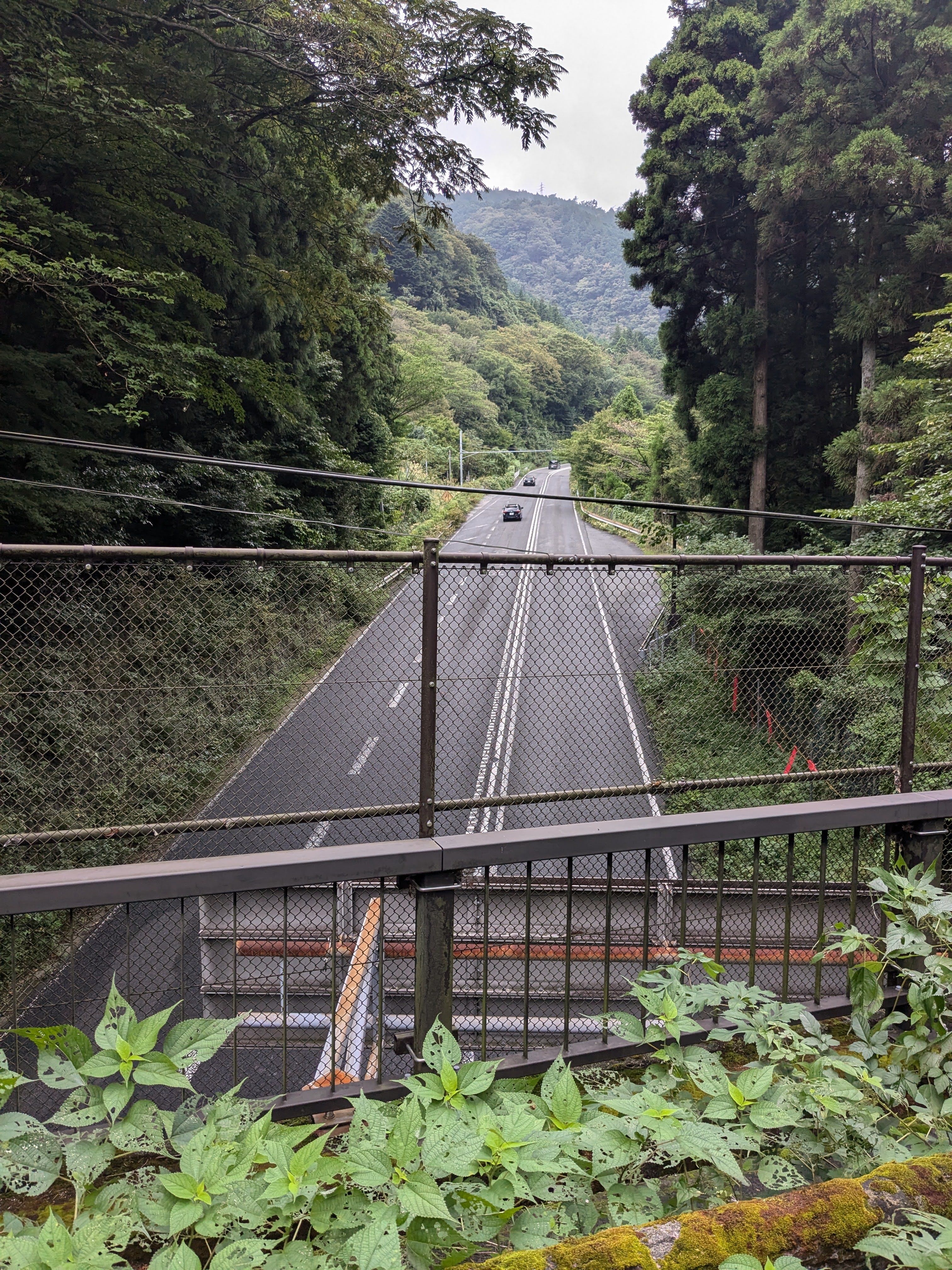 ▲ Stone pavement near the Amazake-Chaya area. The well-known slopes lie just ahead
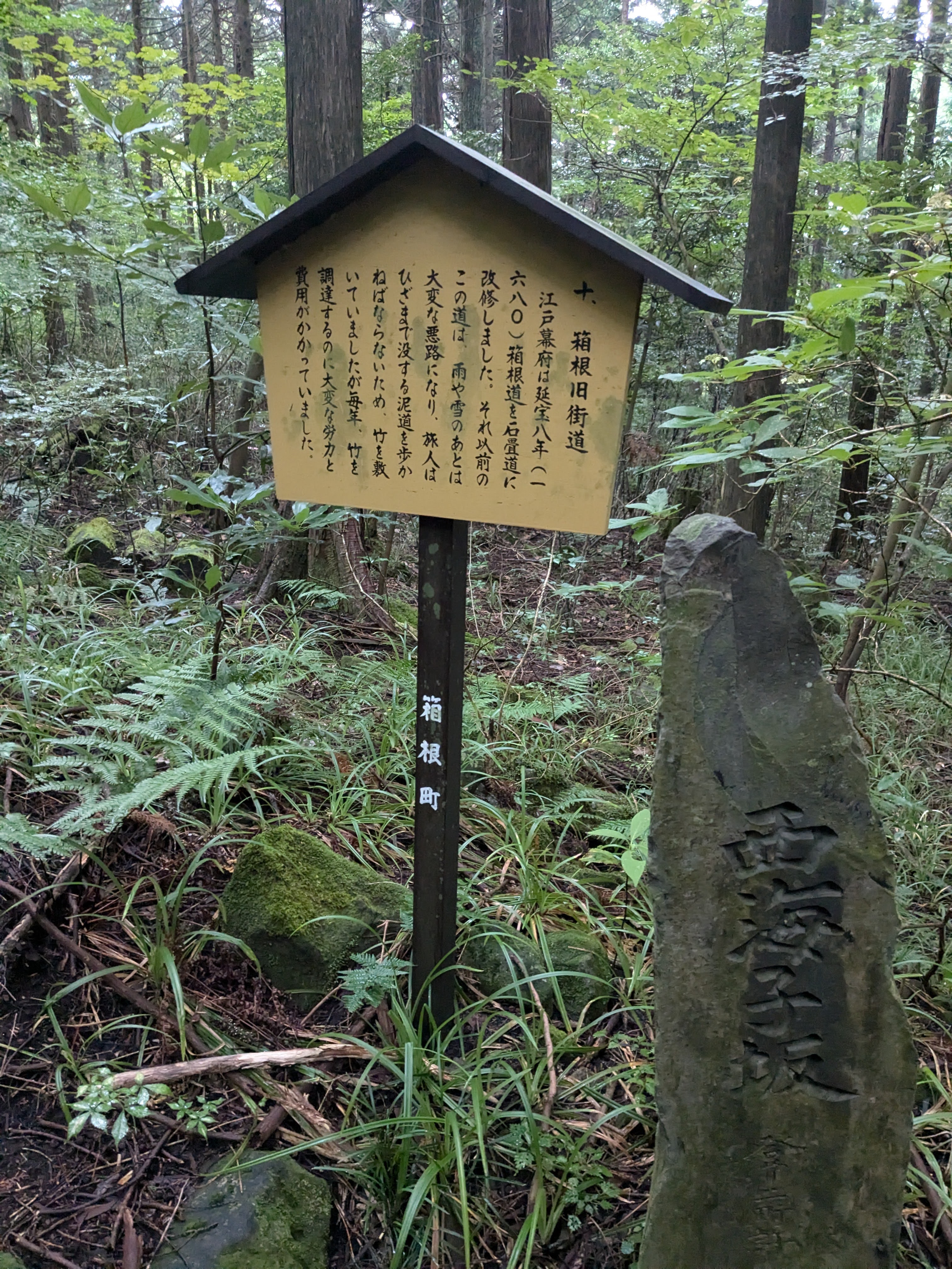 ▲ The Old Road and its cedar forest. The elevation rises steeply from here
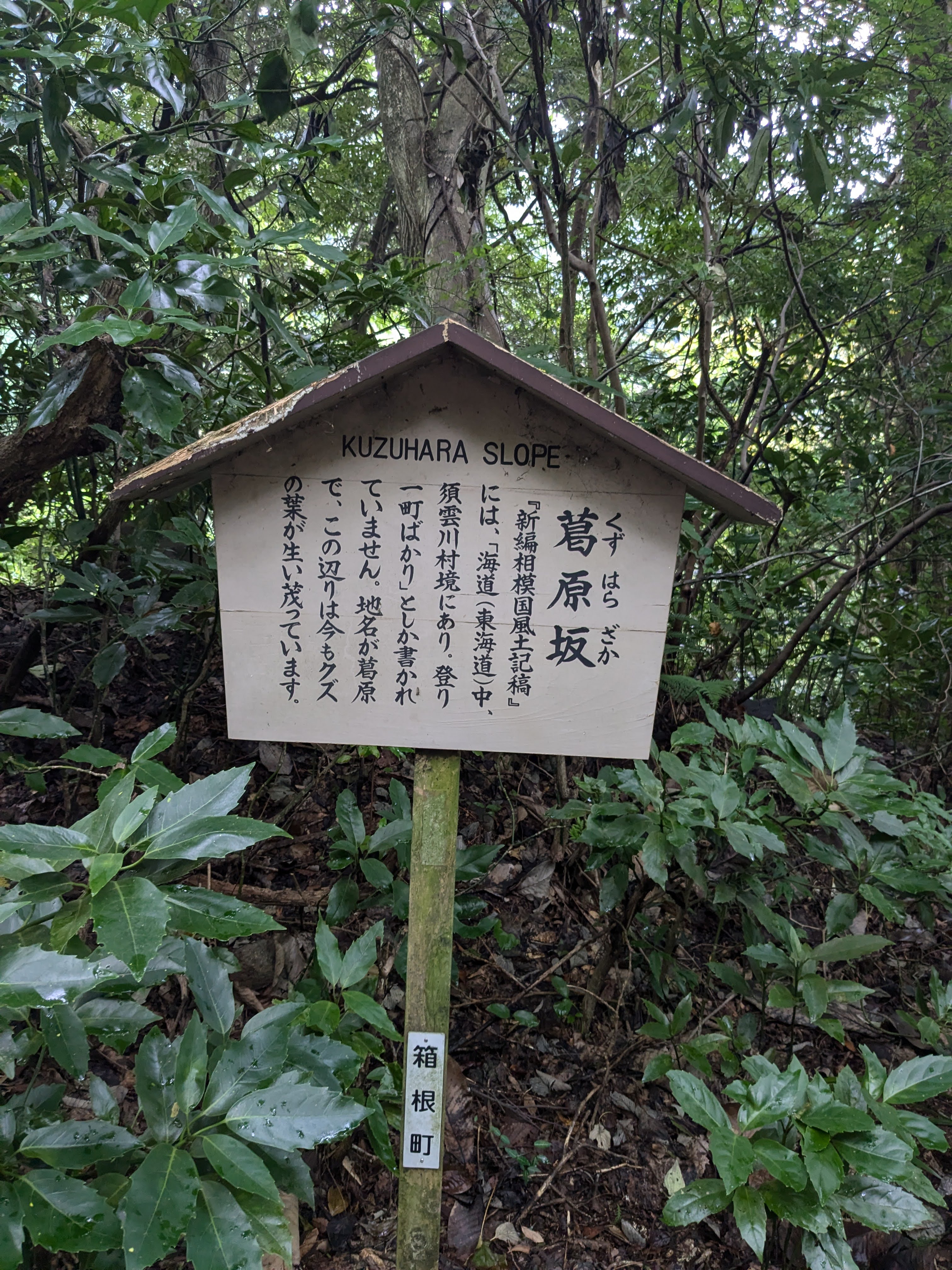
“Dannoki-zaka (Dannoki Slope)”—a Japan Heritage information board stands at the side of the road. This slope was one of the most notorious sections of the Tokaido during the Edo period; the Edo-period gazetteer Shinpen Sagami no Kuni Fudoki-ko (新編相模国風土記稿) describes it as “particularly steep, causing great suffering to many travellers.” Reading the sign made the ancient difficulty suddenly real.
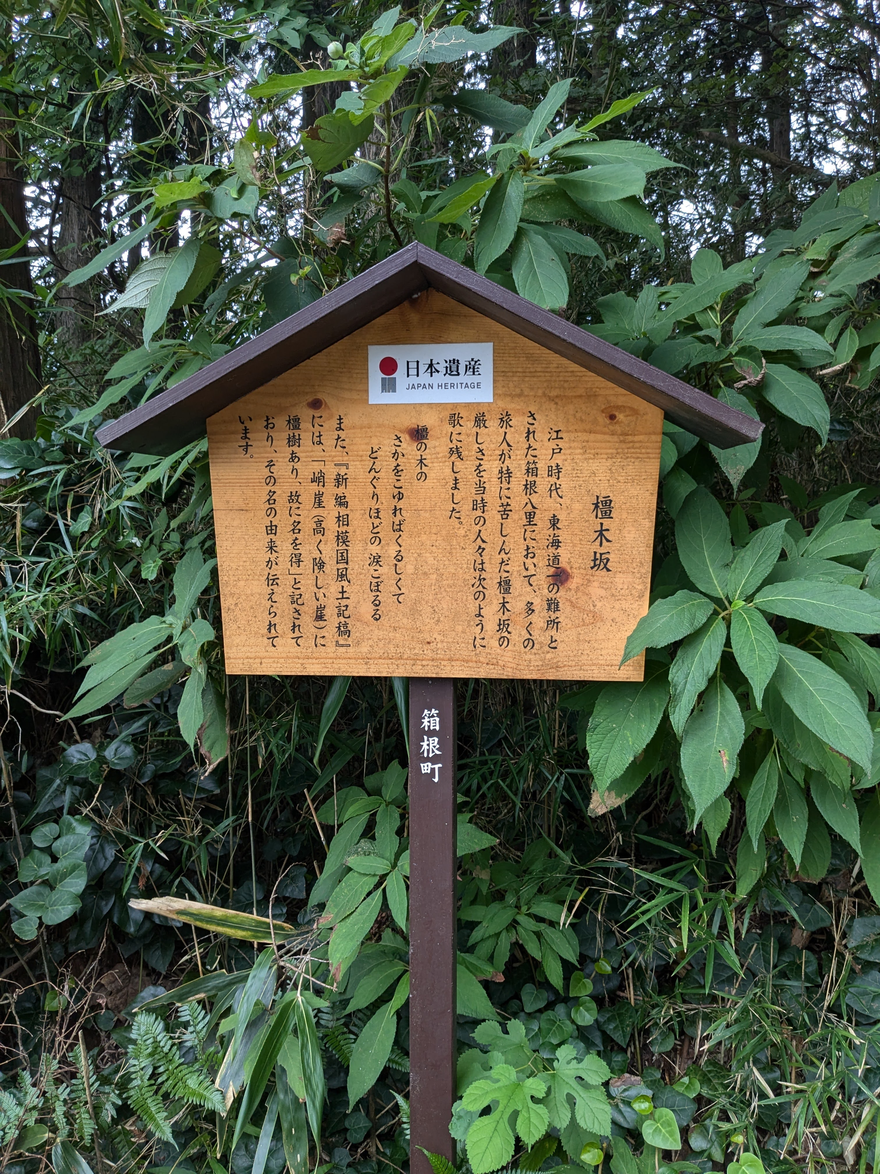 ▲ The Japan Heritage sign for Dannoki-zaka. The explanation provided by Hakone Town is detailed
An old green sign in English and Japanese—“旧街道石畳 Hakone Stone Paved Road”—leans at an angle in the undergrowth. The path is maintained, but its wildness is part of its charm.
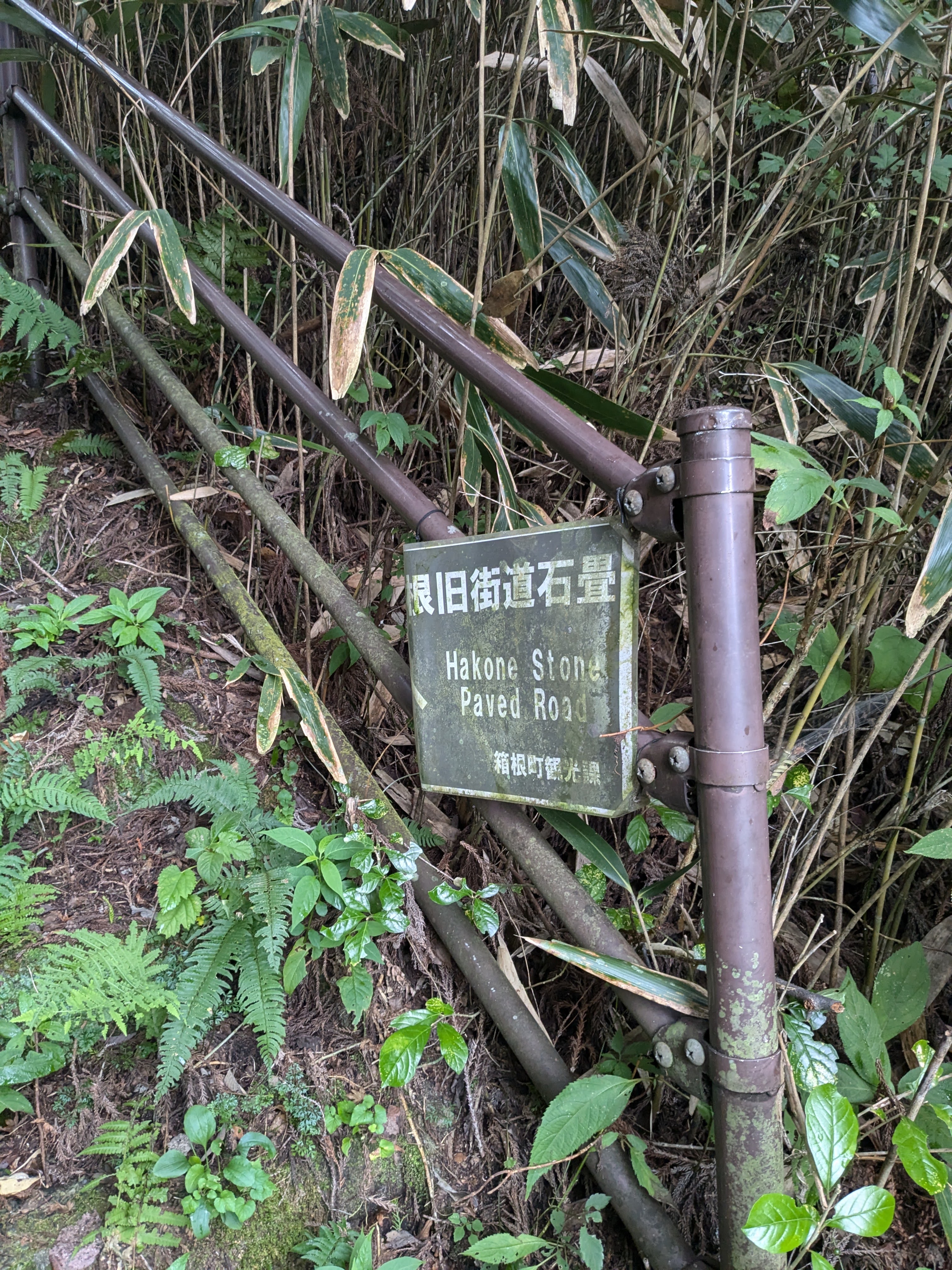 ▲ The sign reading “Hakone Stone Paved Road / Hakone Town Tourism Department.” Tilted, but that adds to the character
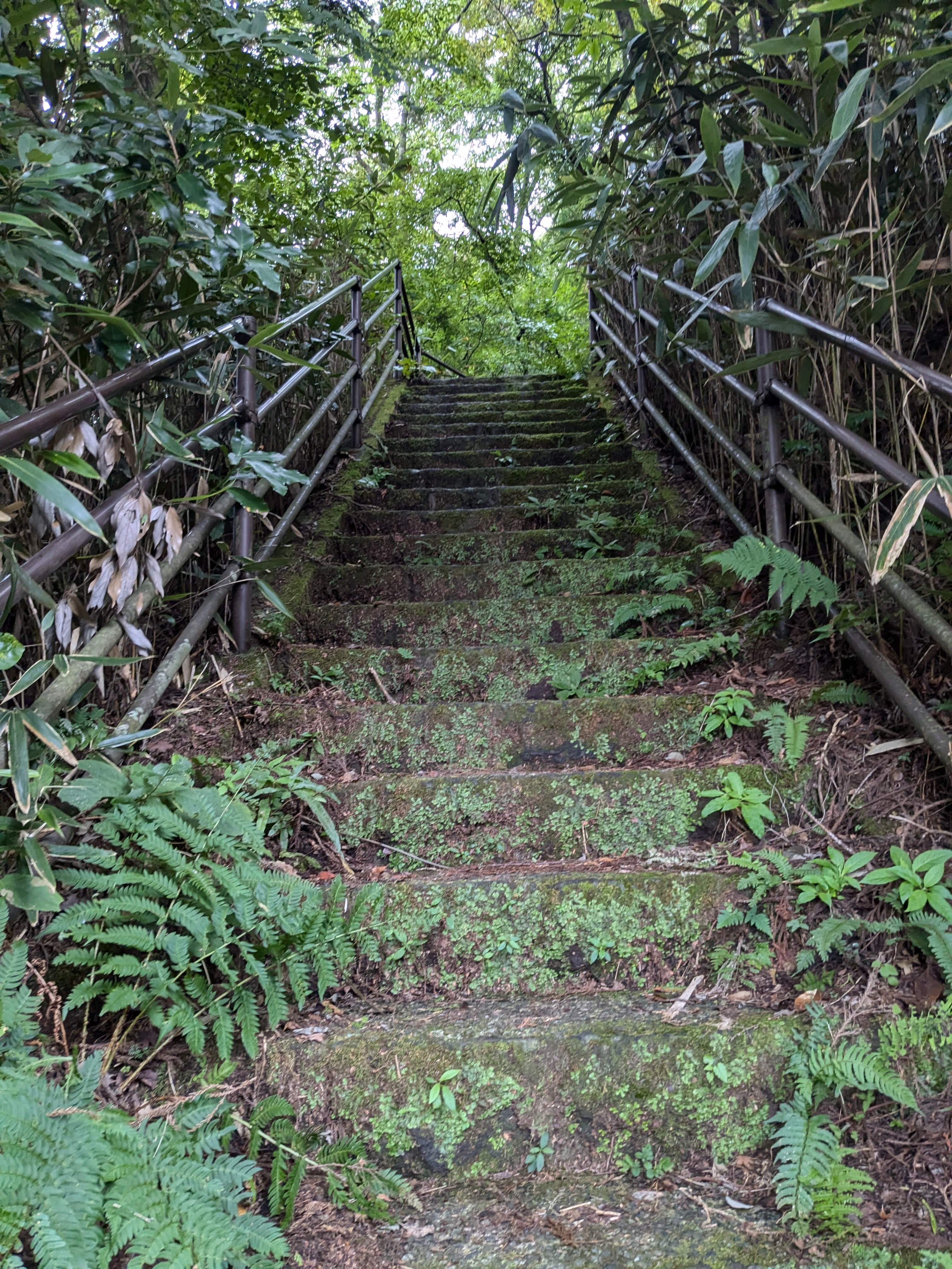 ▲ Stone steps with iron-pipe handrails. Covered in moss, entirely green—a humid, steep ascent
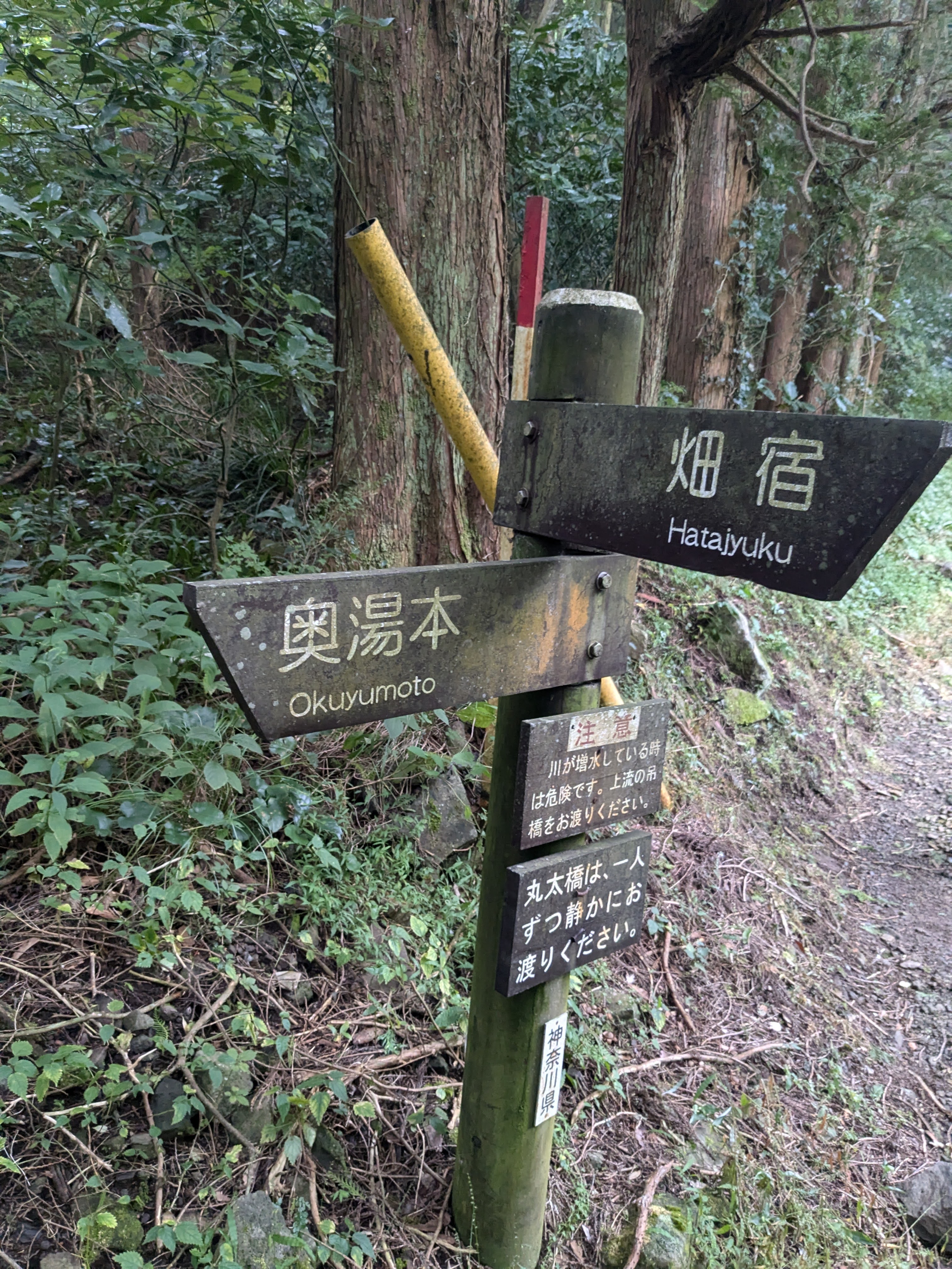
We reached a fork in the path. A signpost indicated “Hatajuku 1.5km” and “Motohakone / Main Road.” Looking back, we had come 1.5 km from Hatajuku. The route ahead continues along the Old Road toward Motohakone.
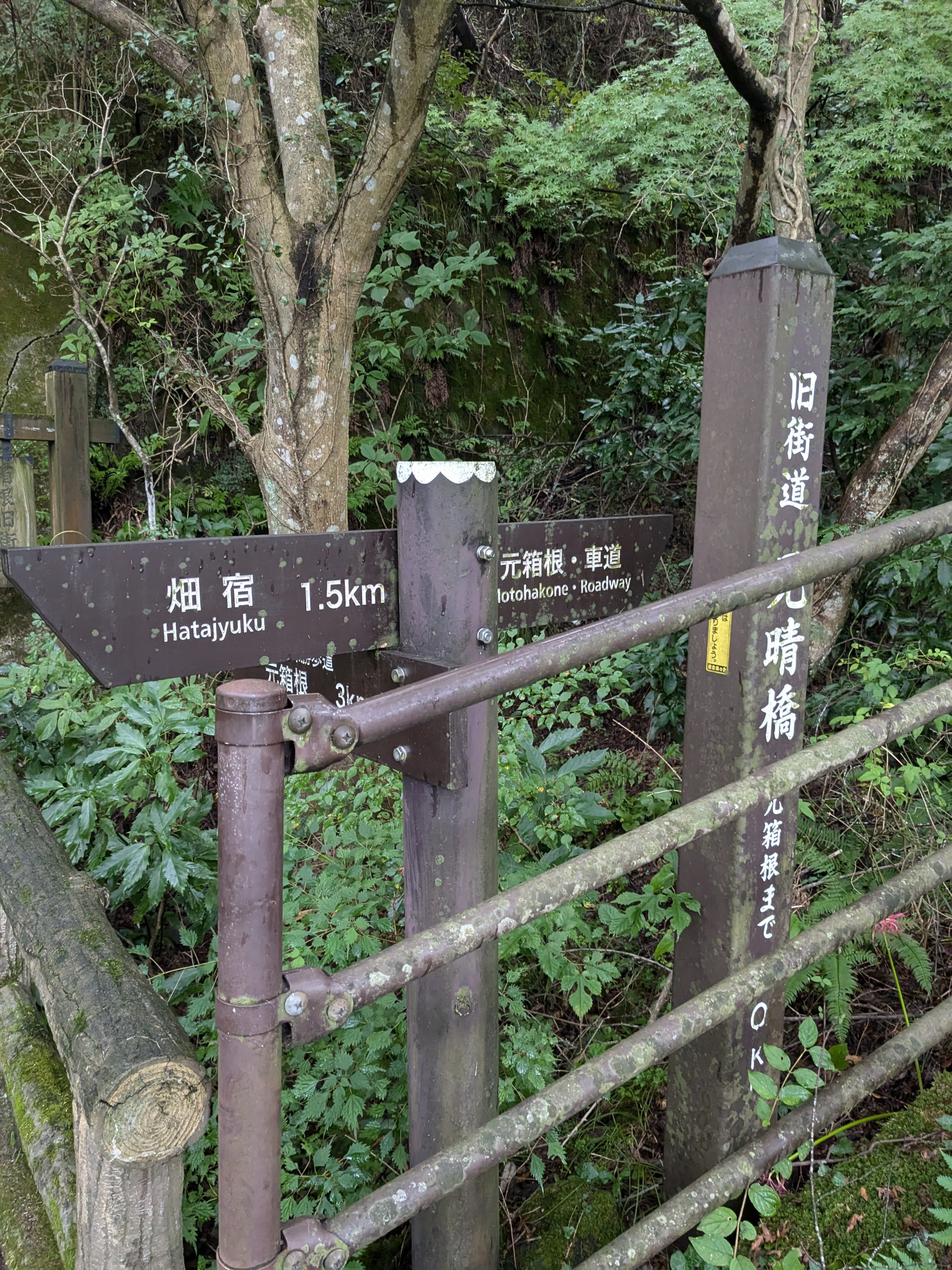 ▲ The fork signpost: “Hatajuku 1.5km,” “Motohakone / Main Road,” and “Old Road / Motohakone Bridge” in three directions
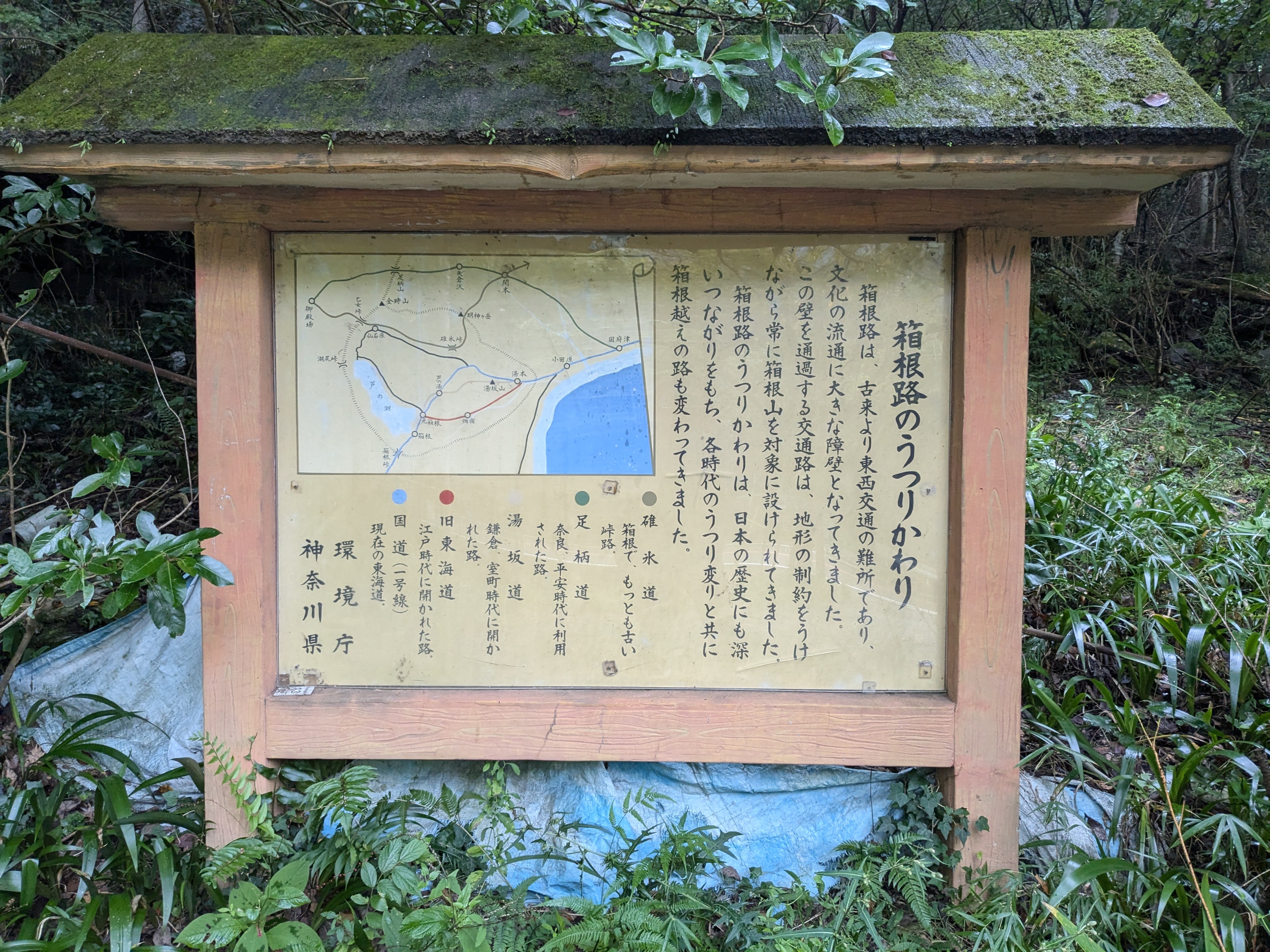
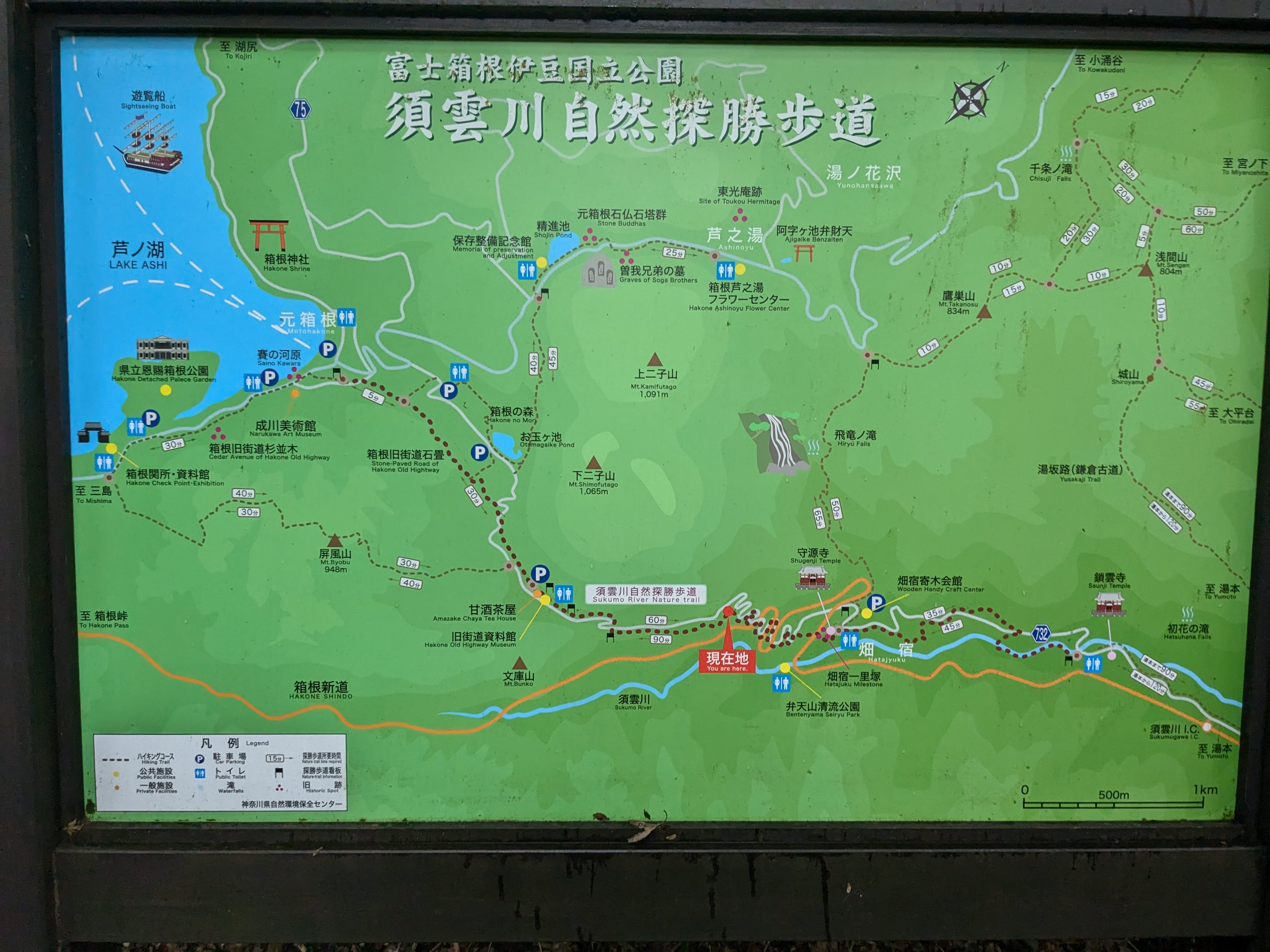 ▲ The full map of the Sukumo River Nature Trail. We are now roughly halfway between Hatajuku and Motohakone
Sarusuberi-zaka and Oikomi-zaka—The Notorious Slopes
Every slope on the Old Road has a name. “Sarusuberi-zaka” (Monkey-Slip Slope)—said to be so steep that even monkeys would slide. “Oikomi-zaka” (Chasing Slope)—a gradient so severe it felt like being driven into a corner. Even on today’s maintained path, the inclination those names describe comes through in your legs.
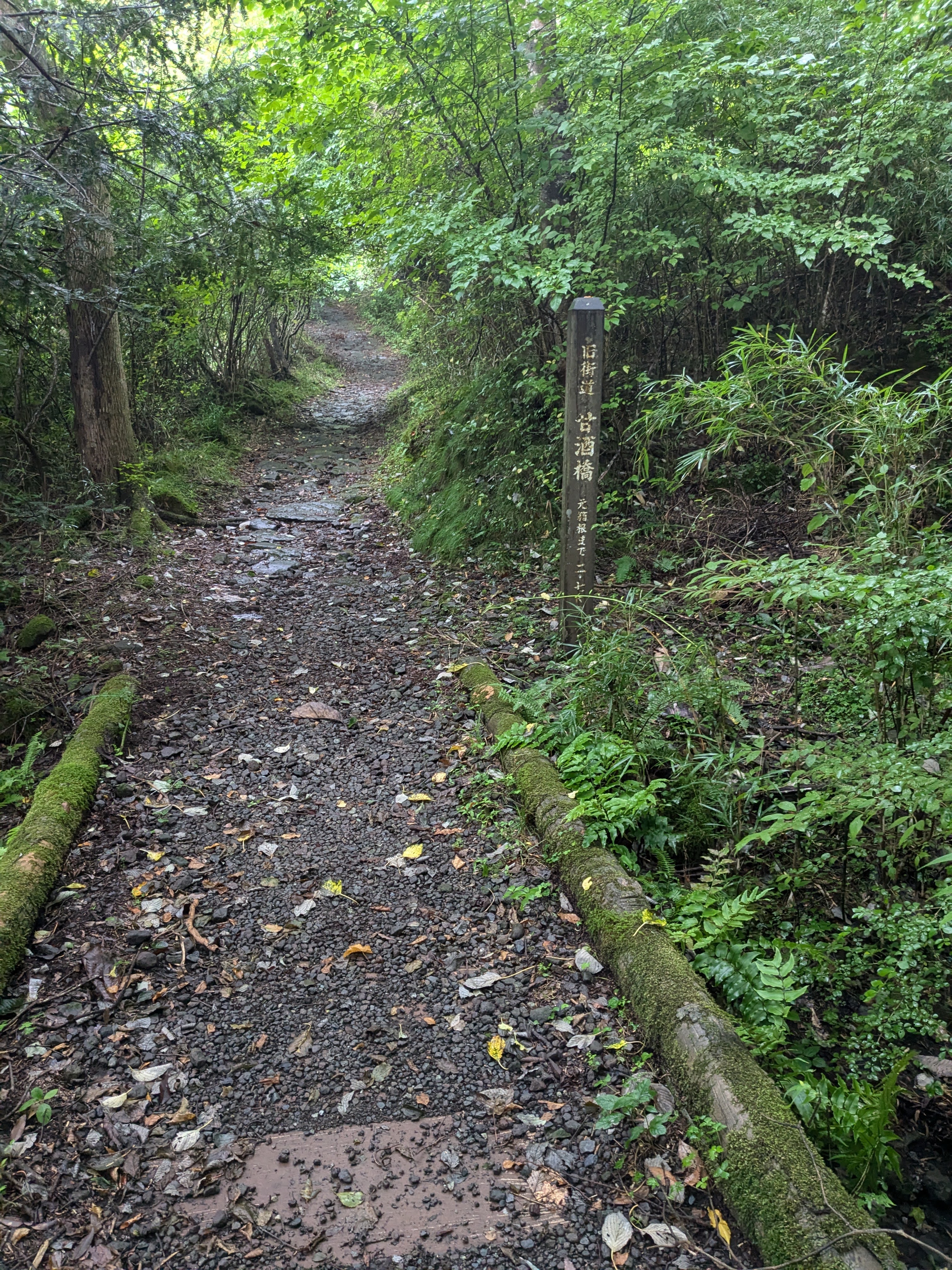 ▲ Stone pavement heading toward the Daishubashi area. The signpost reads “Old Road / Daishubashi / ○○ to Motohakone”
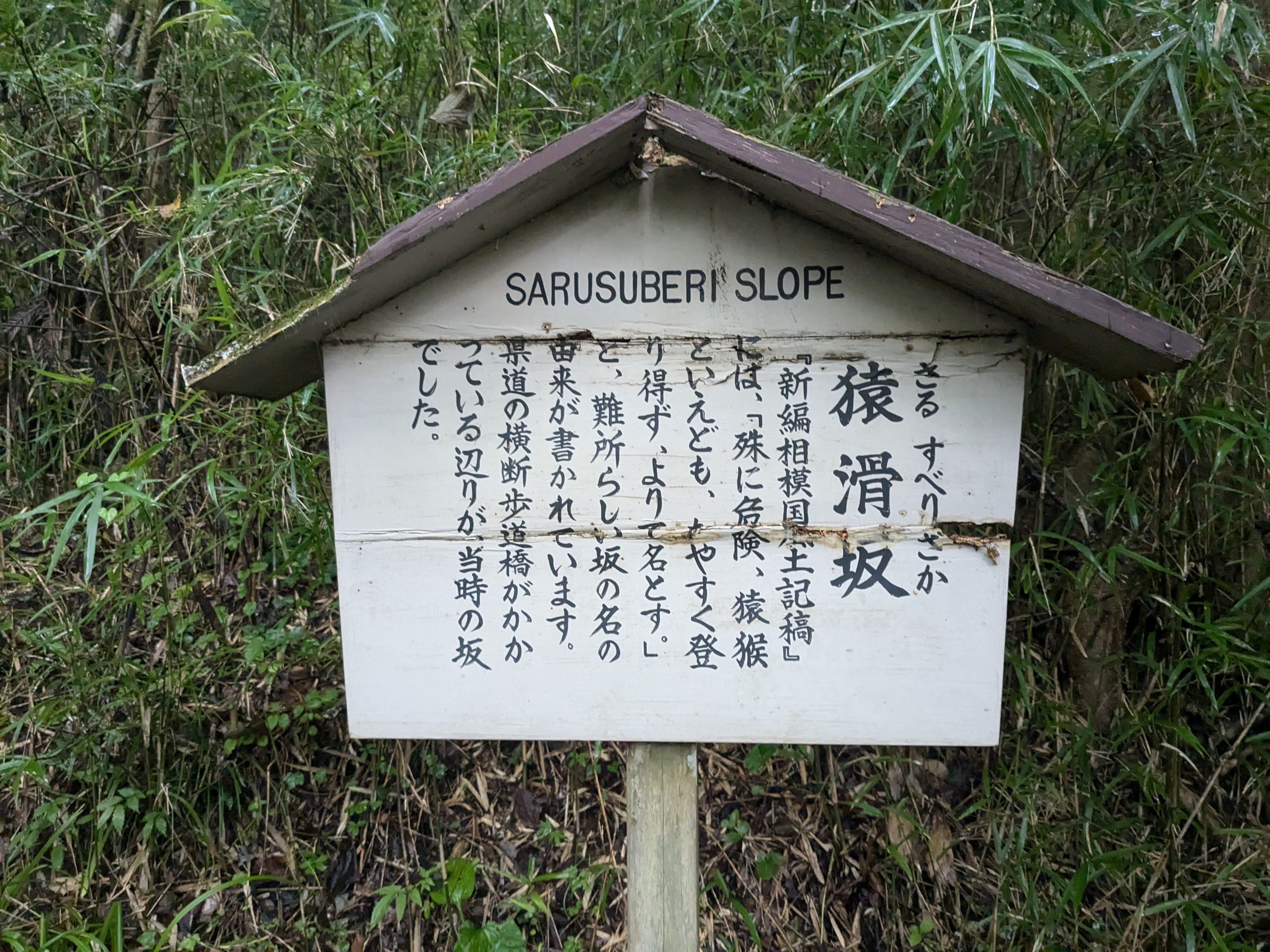 ▲ The explanatory board for Sarusuberi-zaka. It reads: “Particularly steep. Even monkeys couldn’t climb without slipping”
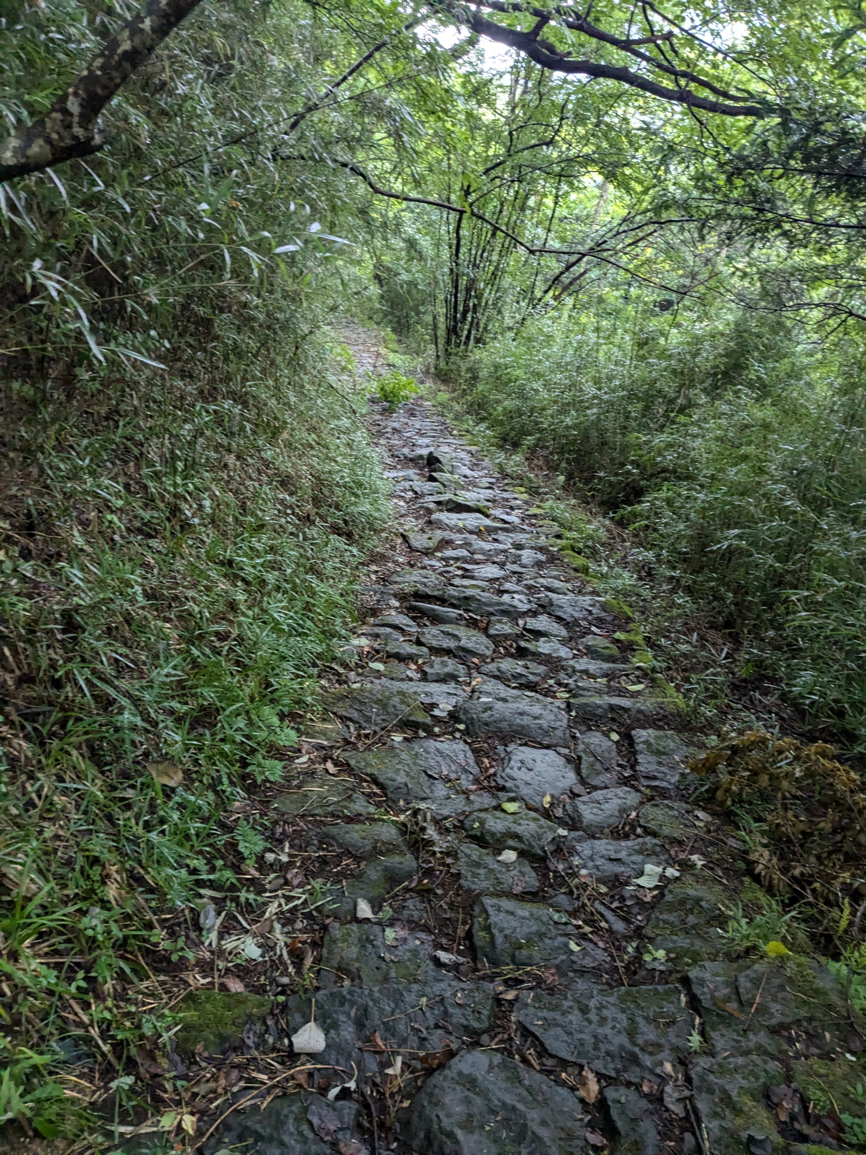 ▲ The Sarusuberi-zaka section. A narrow stone path flanked on both sides by bamboo, heading steeply upward
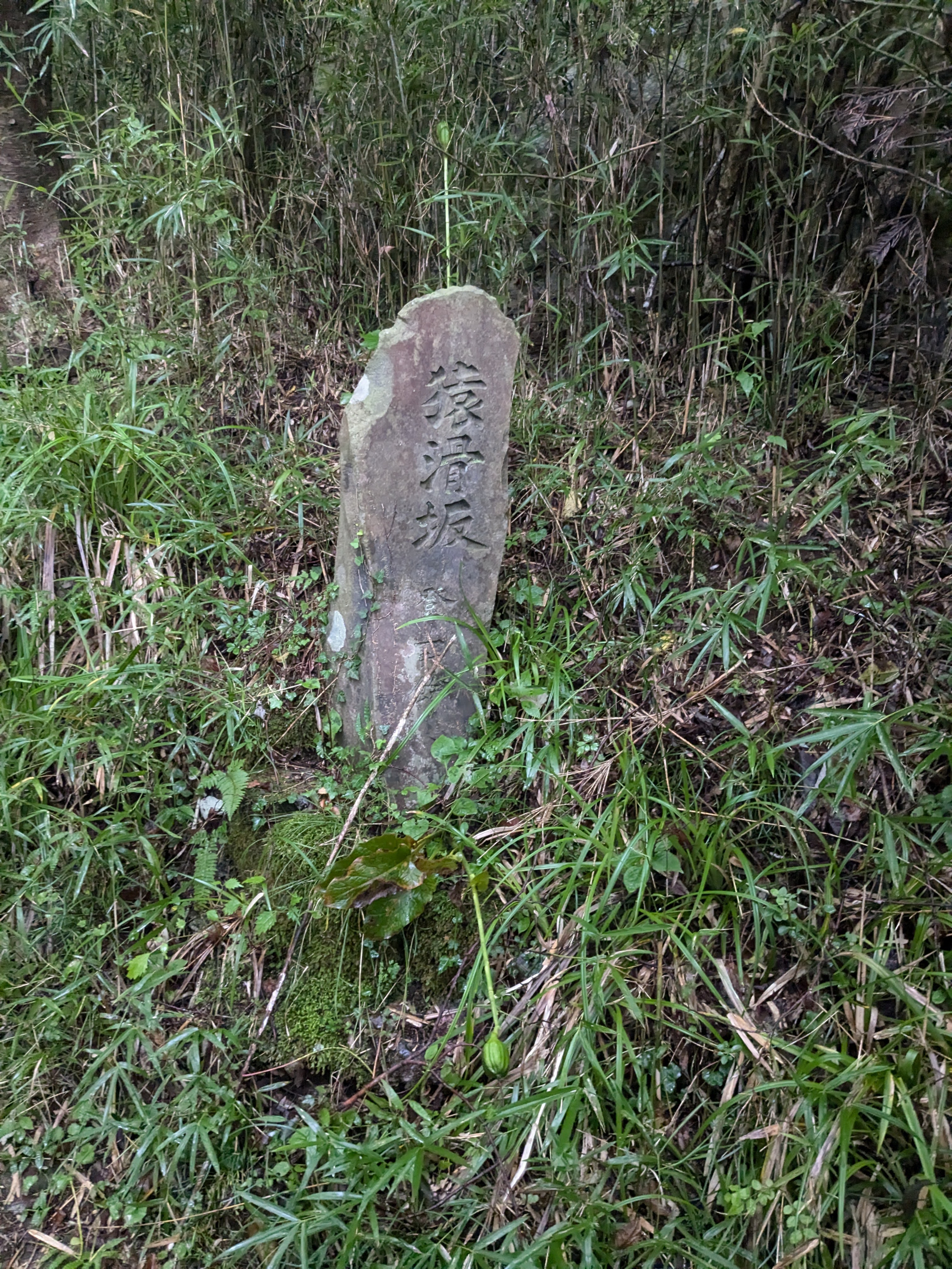 ▲ A stone monument carved with “Sarusuberi-zaka.” Covered in moss, it has the gravity of something that has stood since the Edo period
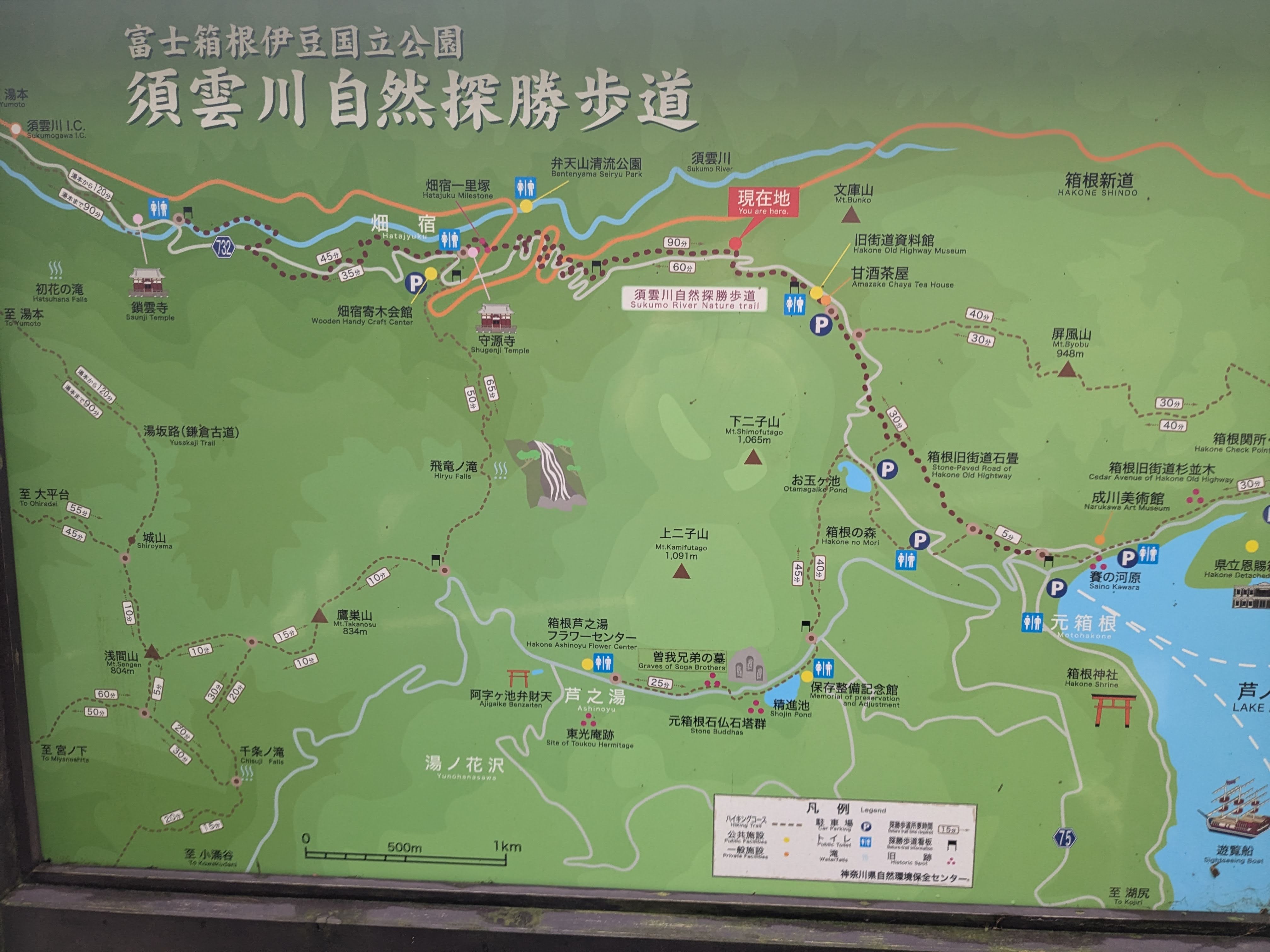 ▲ Another version of the Sukumo River Nature Trail map. Only a short distance remains to Motohakone
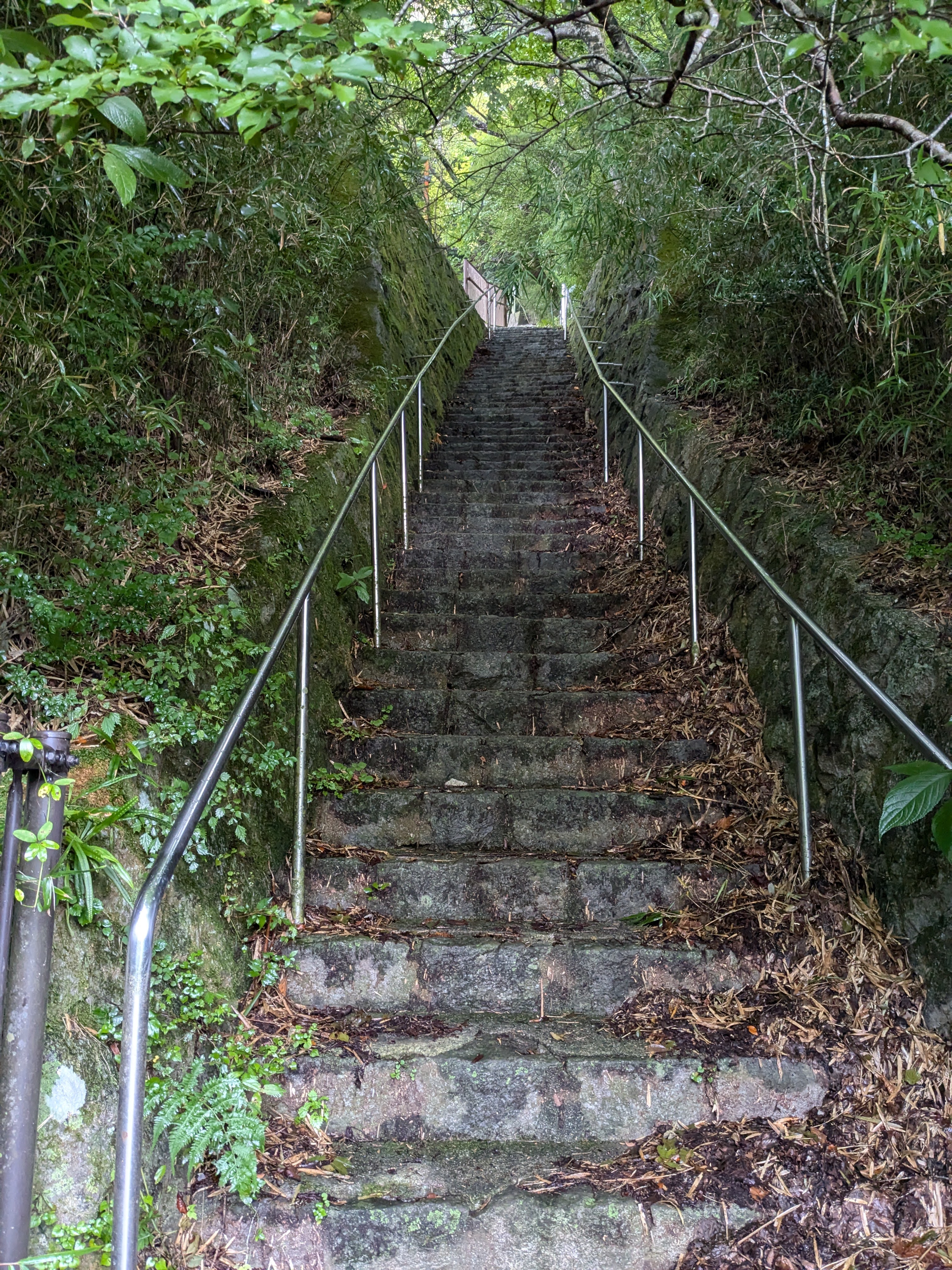 ▲ A steep stone staircase along a wall of stacked rocks. The ancient stonework adds to the old-road atmosphere
A wooden post for “Oikomi-zaka (OIKOMI SLOPE)” appears. Next to it stands a sign pointing to “元箱根 Motohakone.” We’re almost there.
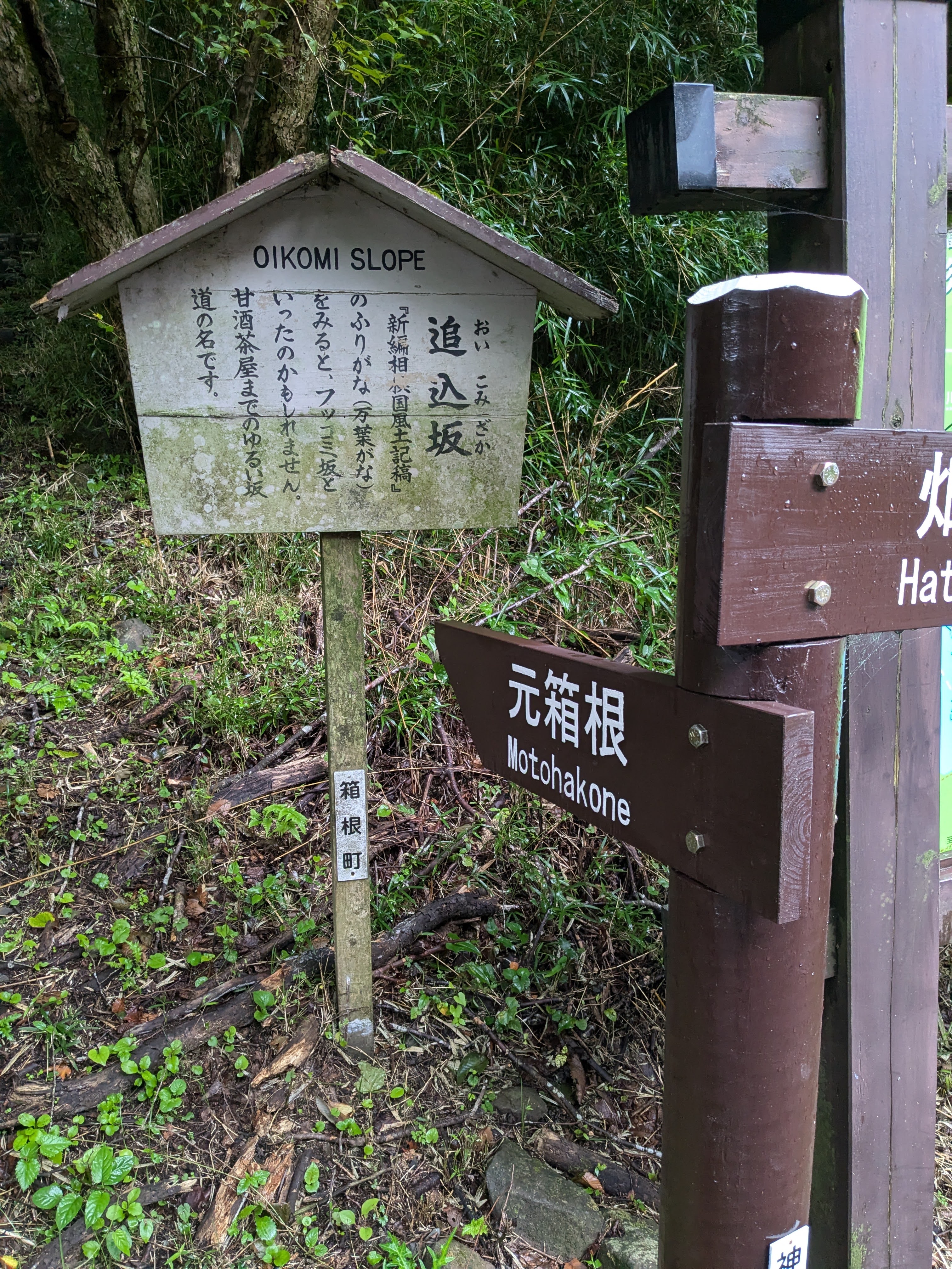 ▲ The Oikomi-zaka board and the “Motohakone” signpost side by side. A clear sign that the goal is near
The Cedar-Lined Stone Pavement—the Highlight of the Old Road
A large wooden gate appears, reading “Hakone Old Road / 40 minutes to Motohakone.” Beyond it lies the most photogenic stretch of the entire route.
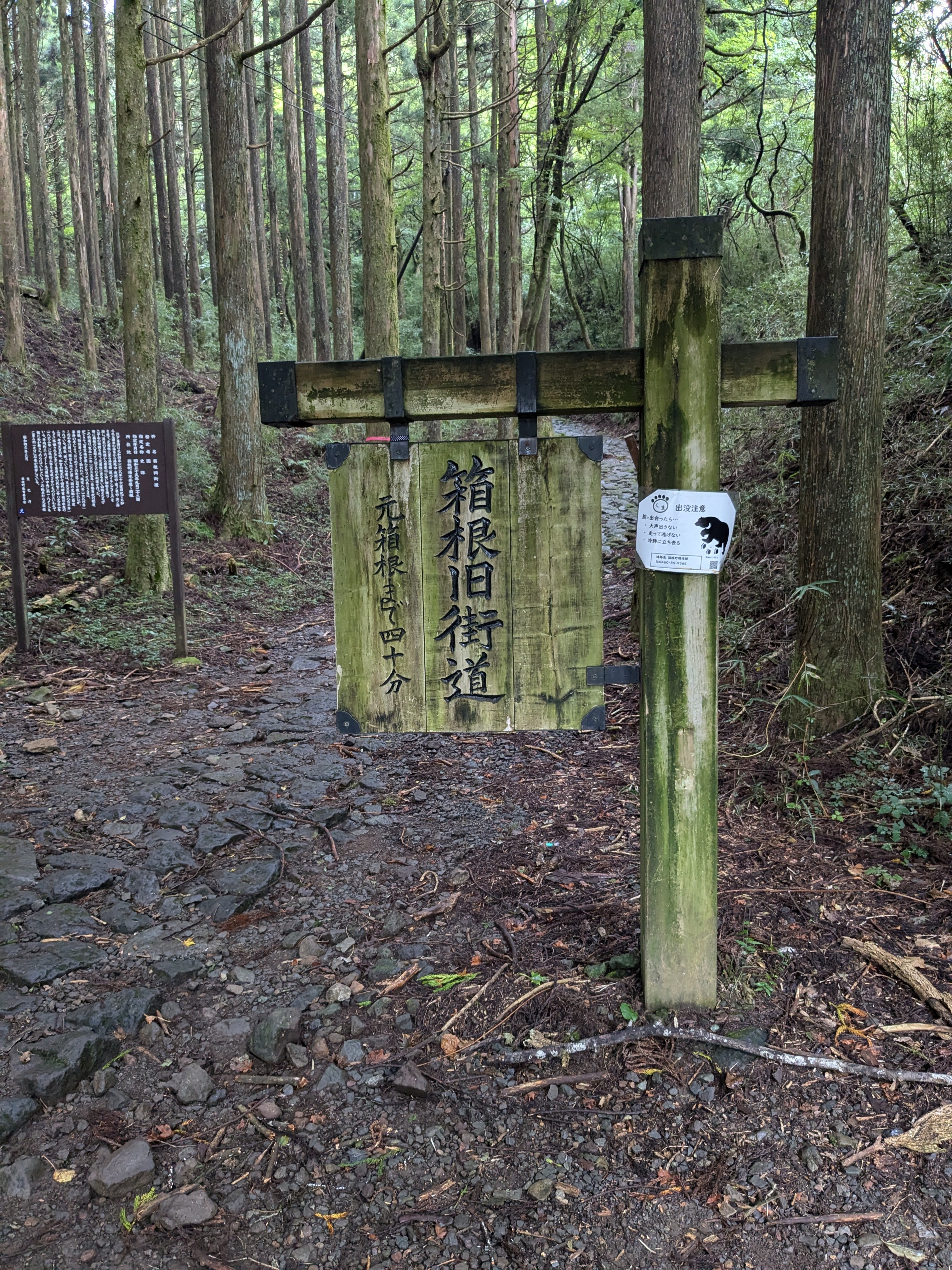 ▲ A wooden gate reading “Hakone Old Road / 40 minutes to Motohakone.” The famous cedar-lined section begins here
The stone pavement stretches on. On both sides, towering cedars—30 metres or more—stand in a solemn procession, turning the path into something resembling a sacred approach. When this scene opened up in front of us—the same view we had seen in photographs—the fact that samurai processions once marched through here more than three hundred years ago suddenly became tangible.
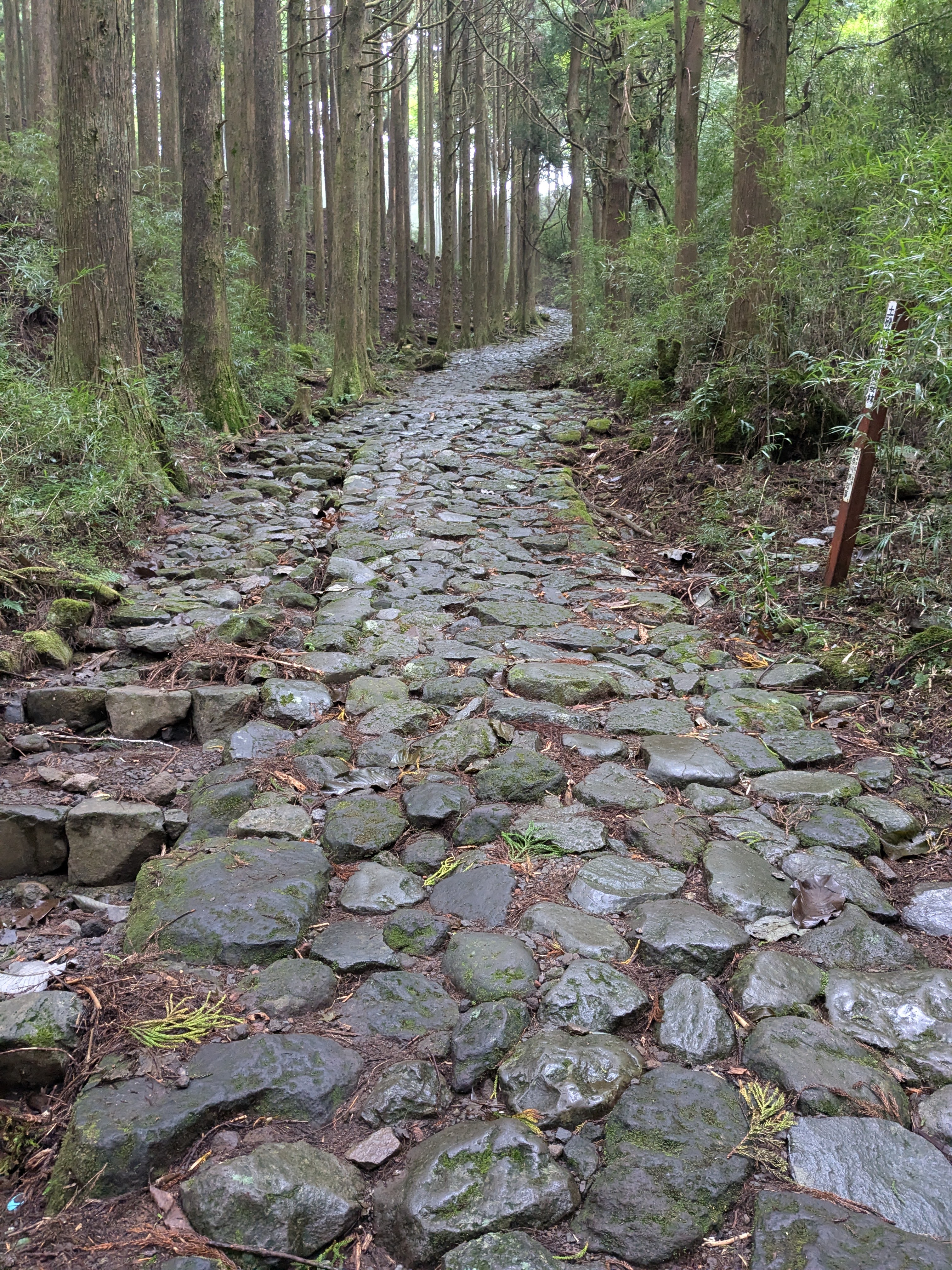 ▲ Stone pavement through the cedar forest. This is exactly what we came for. The great cedars enclose the path, creating an otherworldly space
Through the Mt. Futago Area, Down to Motohakone
After the cedar forest, we entered an area with information boards about Mt. Futago (二子山). Details on Hakone’s volcanic topography and vegetation, with a trail feel to the surroundings.
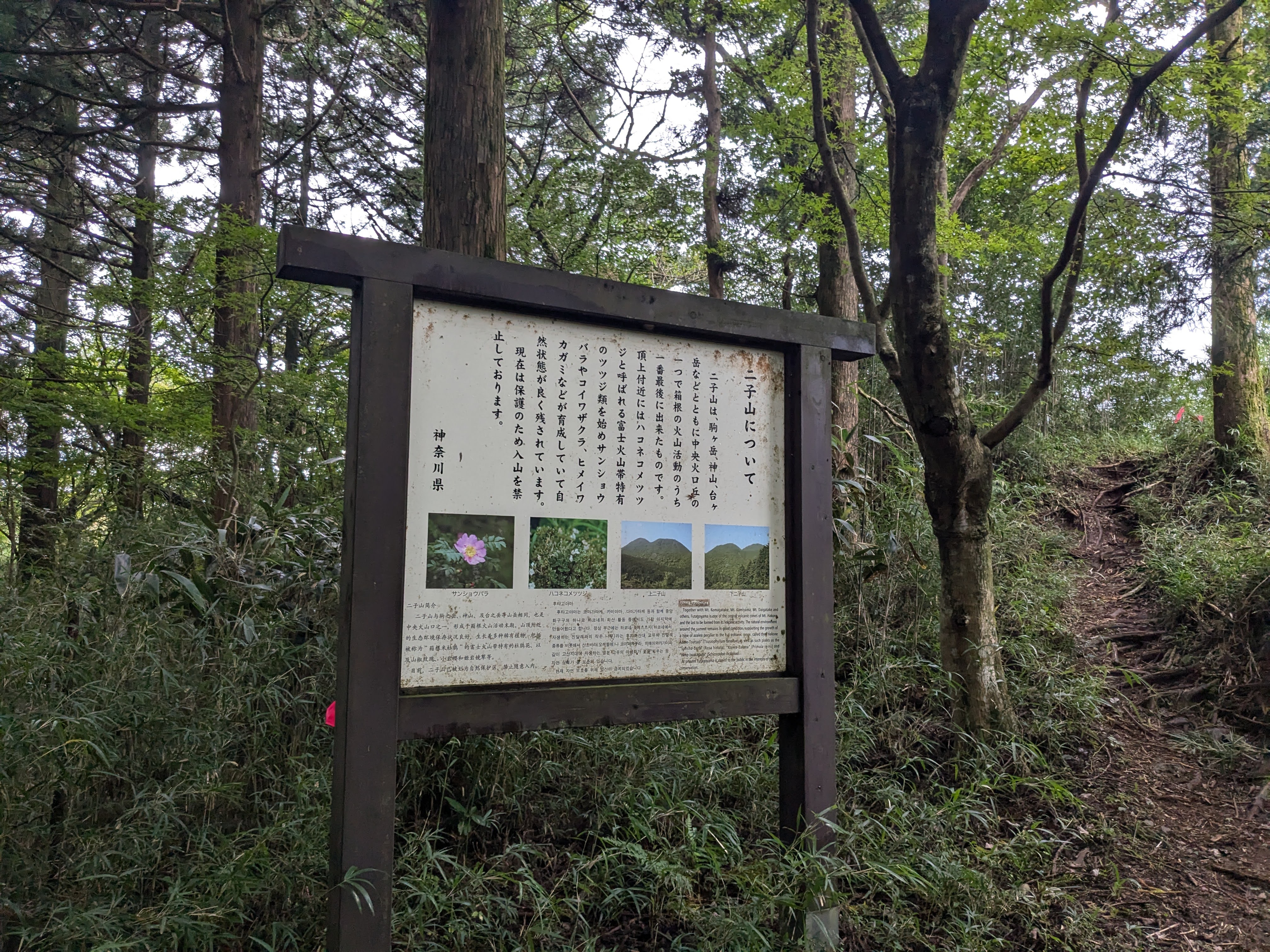 ▲ The Mt. Futago information board. Detailed explanations of Hakone’s volcanic terrain and plant life
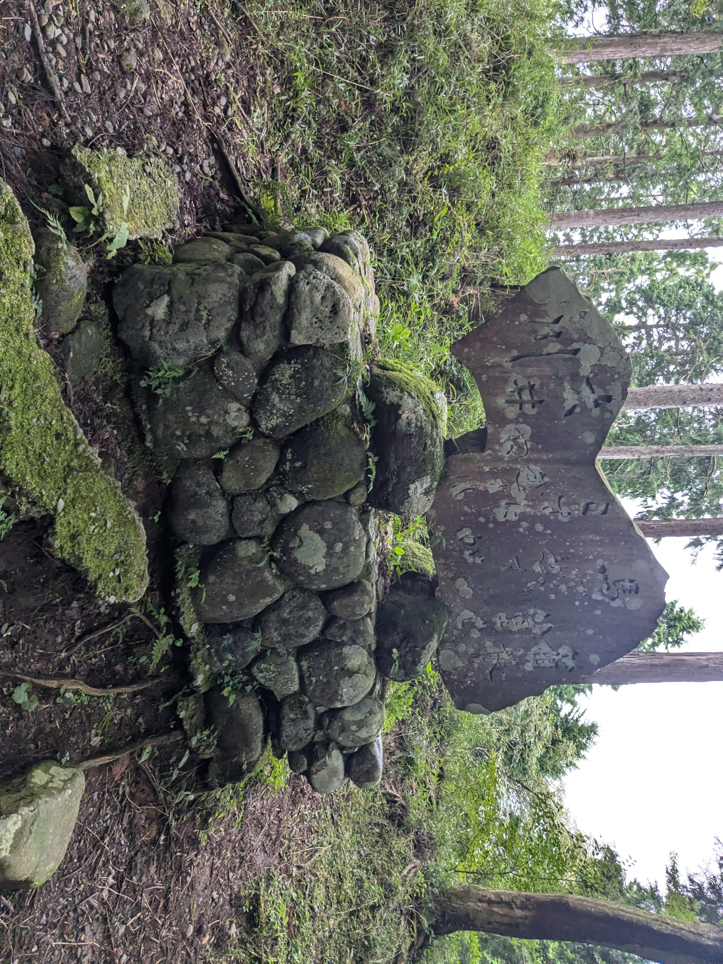 ▲ A stone monument and stacked-stone structure. Moss-covered stones stand quietly in the deep forest
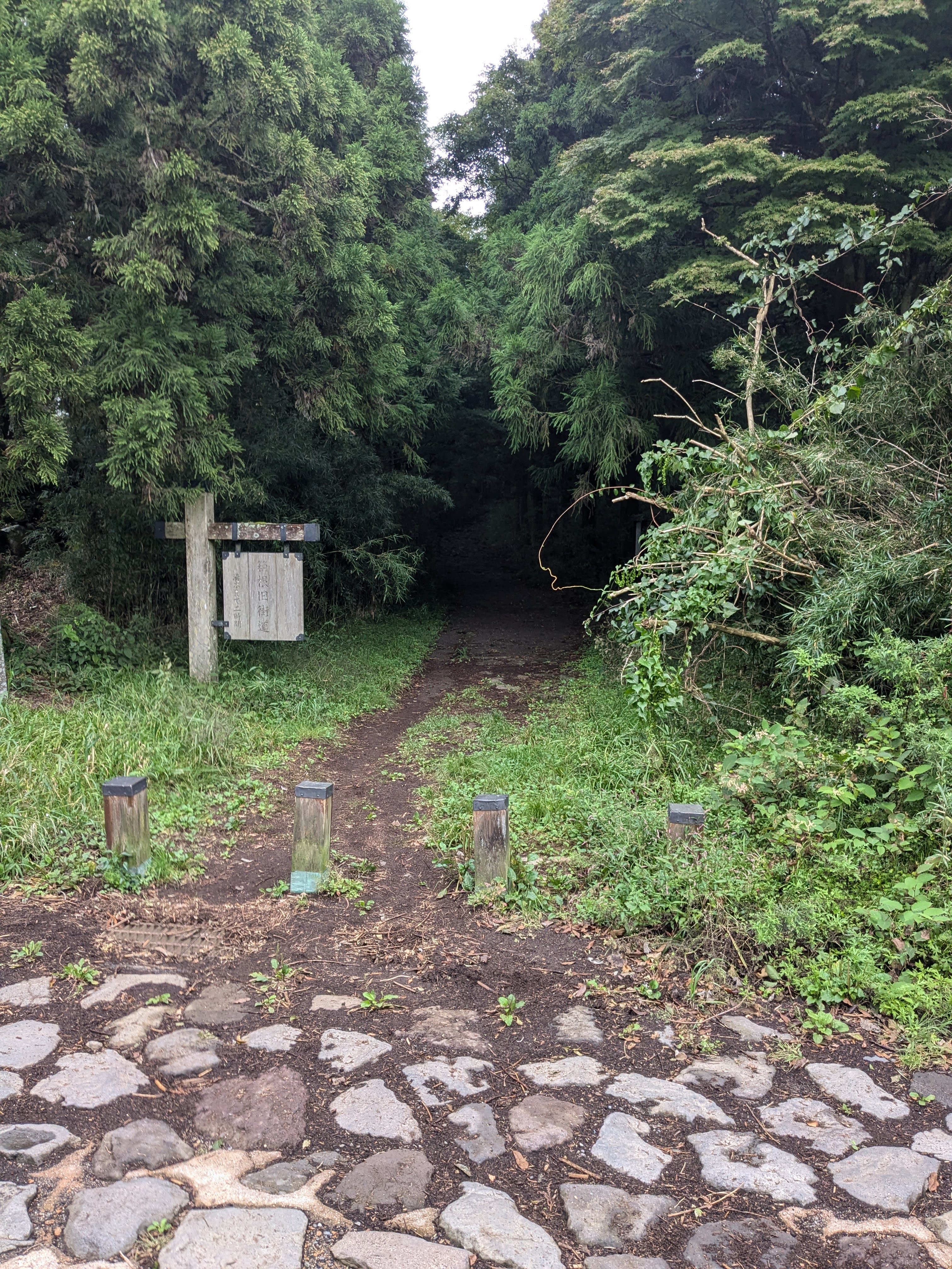 ▲ The entrance to the Old Road heading deep into the forest. Stone pavement, a wooden fence, and a dark, mysterious interior
“Slope No. 16: Enoki-no-Genzaka”—the sixteenth slope counting from Odawara. A stone monument and wooden explanatory board stand here. The Old Road reportedly had 17 named slopes in total, each numbered from Odawara.
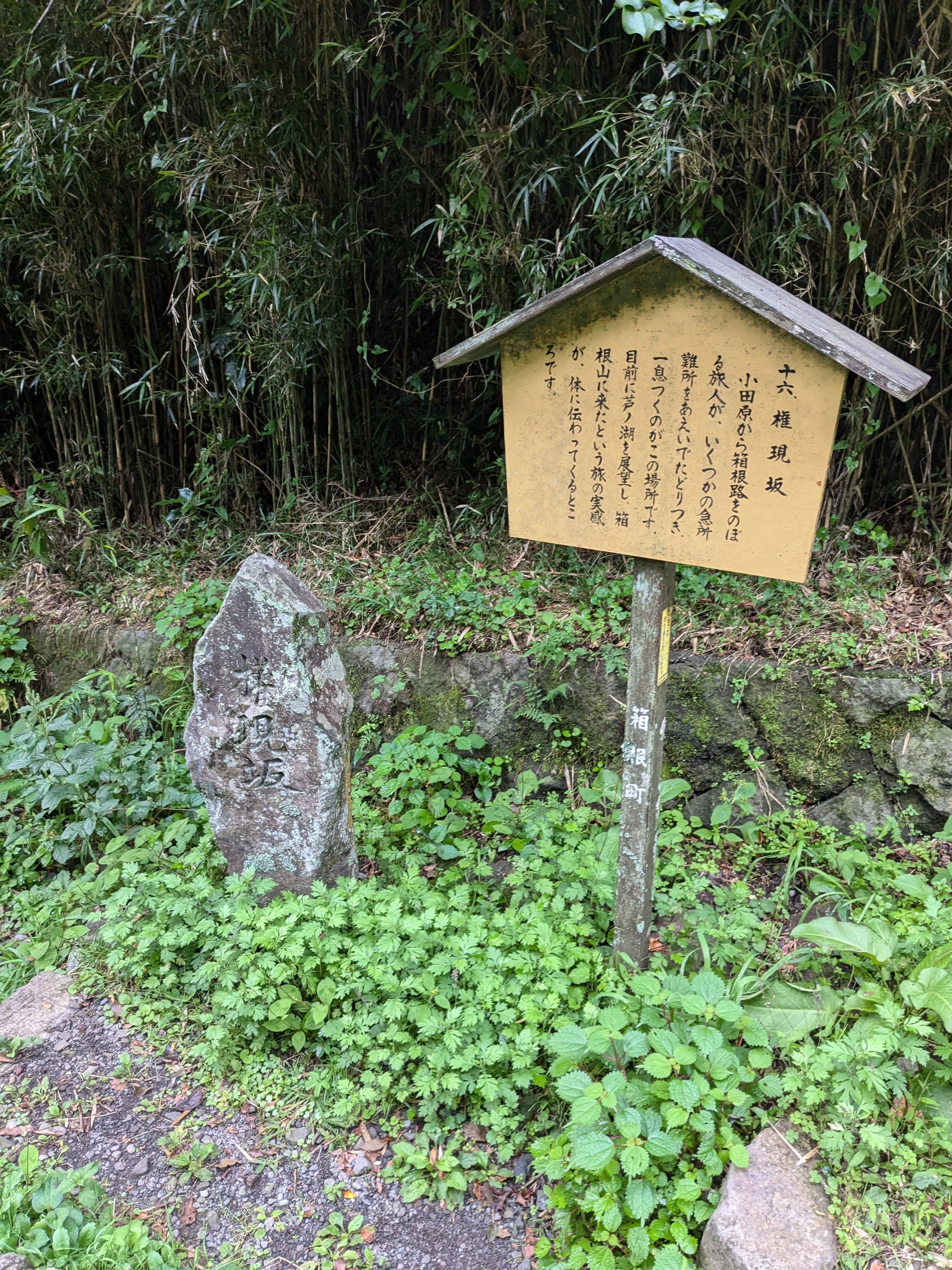 ▲ The monument and board for “Enoki-no-Genzaka”—the sixteenth slope from Odawara
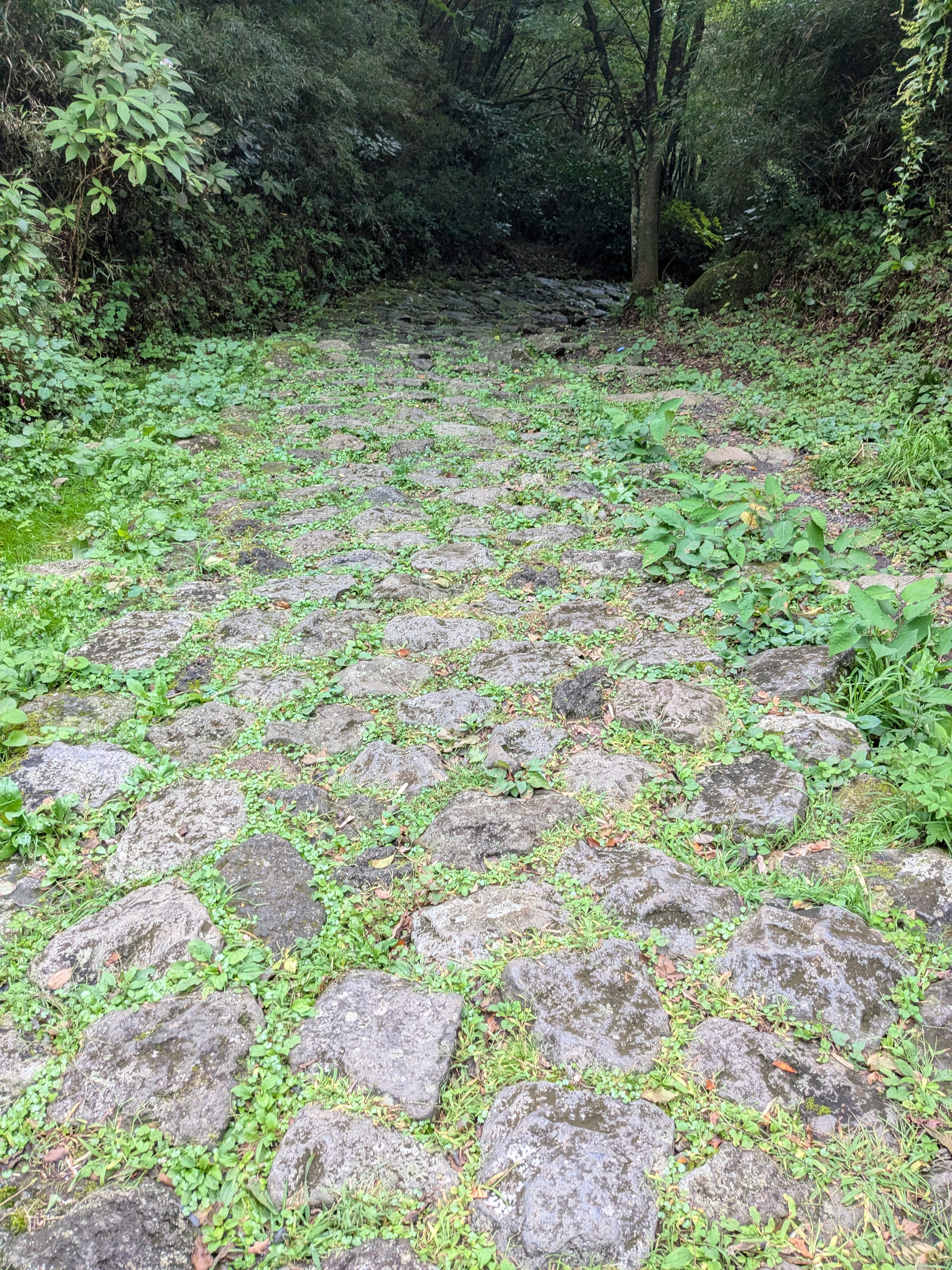 ▲ A wide, flat section of stone pavement covered in grass. A beautiful contrast of green and grey stone
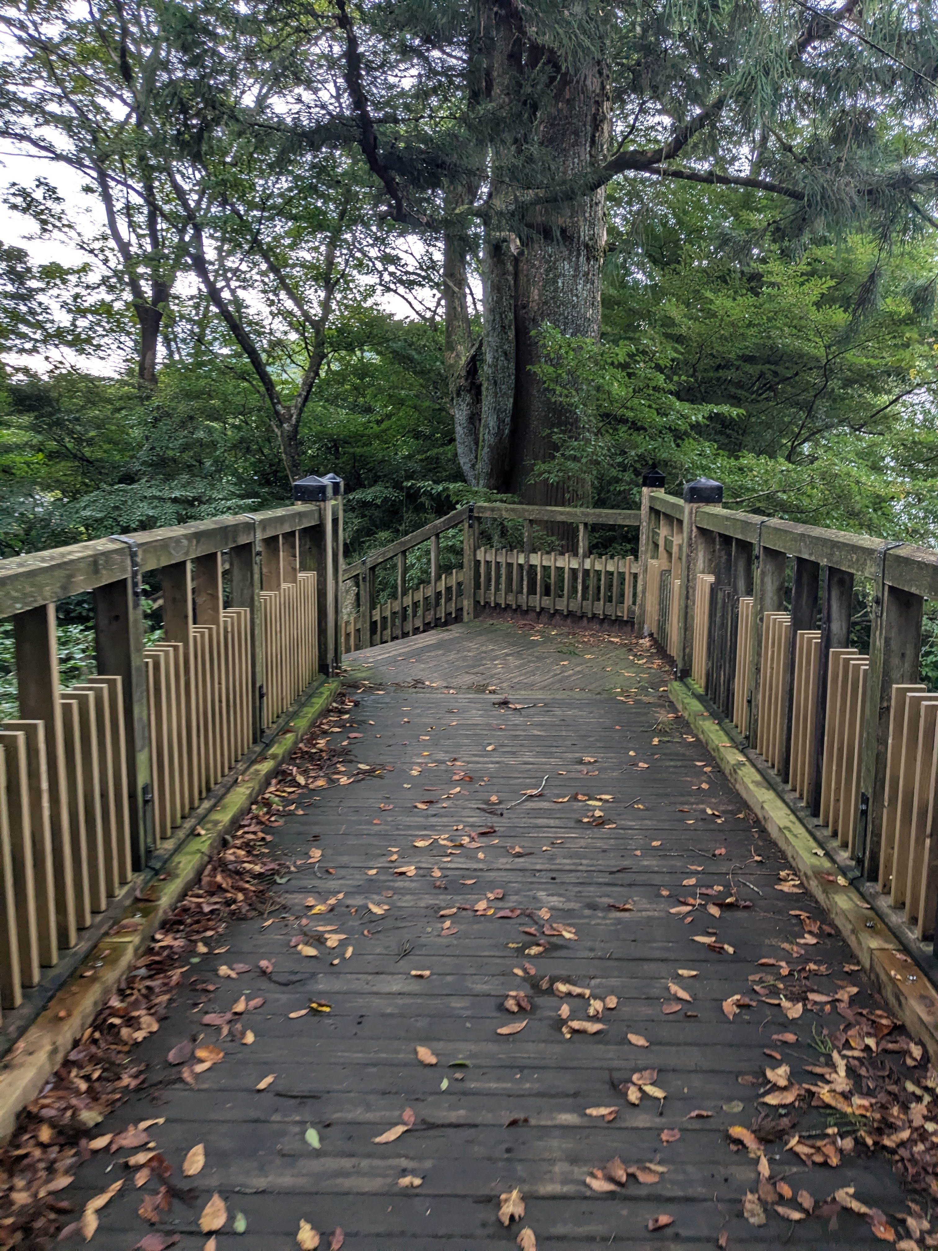 ▲ A wooden bridge crossing through the forest. Fallen leaves before the autumn colour change cover the planks
And then—Lake Ashi (Ashinoko) opened up before us.
Near the boat pier at Motohakone. Under an overcast sky, the quiet lake surface stretched out, surrounded by mountains. The harbour jetty was visible to the right. Three hours of walking had brought us here, and the satisfaction mixed with the lake’s silence kept us standing still for a while. Mt. Fuji was hidden in cloud, but the scene was beautiful enough without it.
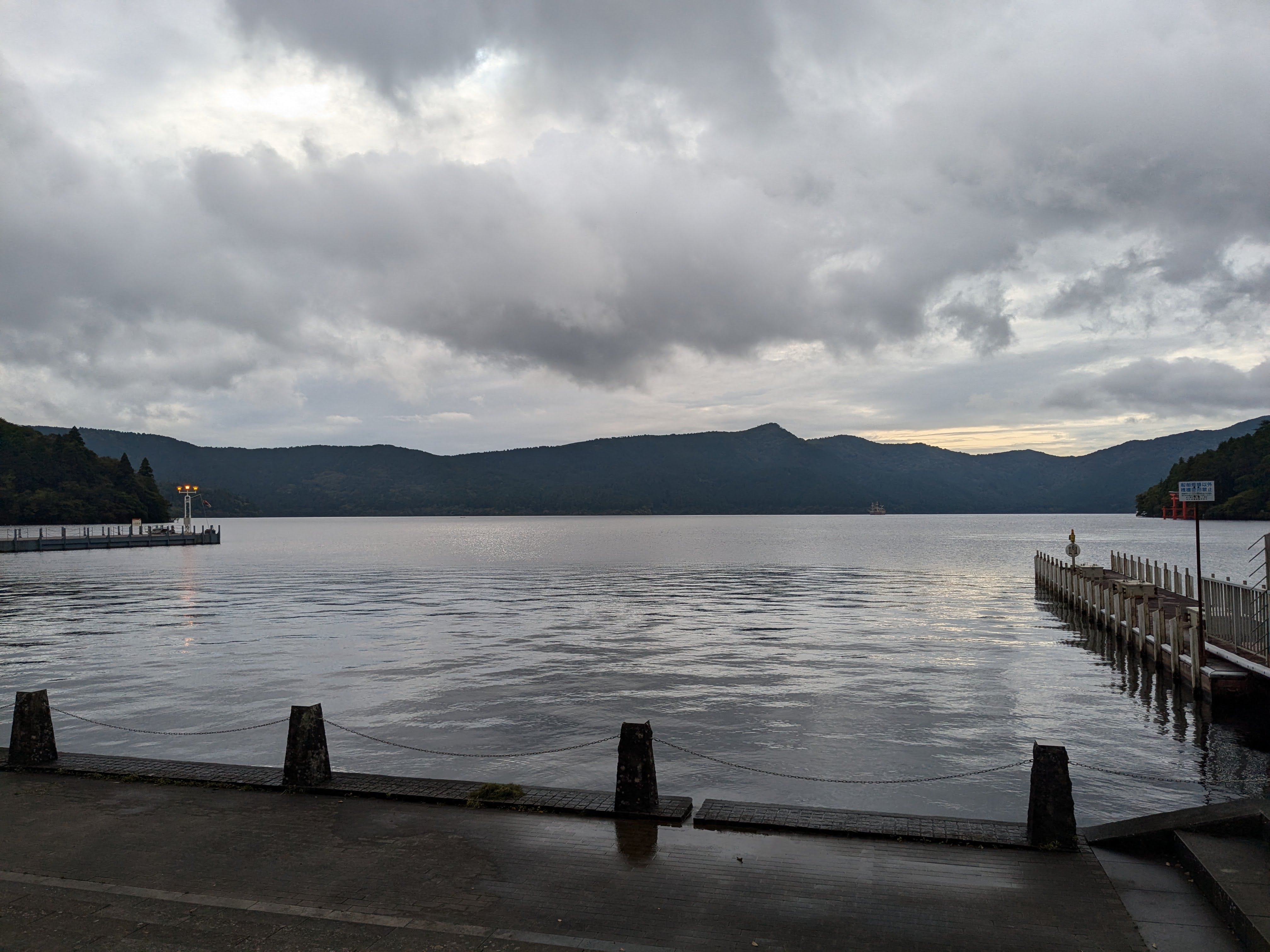 ▲ Lake Ashi seen from Motohakone harbour. The overcast sky reflects on the lake surface, calm and serene. The jetty is visible to the right
Tonight’s Accommodation: Hotel Biore
A short walk from Motohakone brings you to Hotel Biore, tonight’s stay. The stone exterior gives it a European-hotel feel, standing quietly in the forest. After check-in and dropping luggage in the room, we rested in the quiet until the time for the hot spring and dinner.
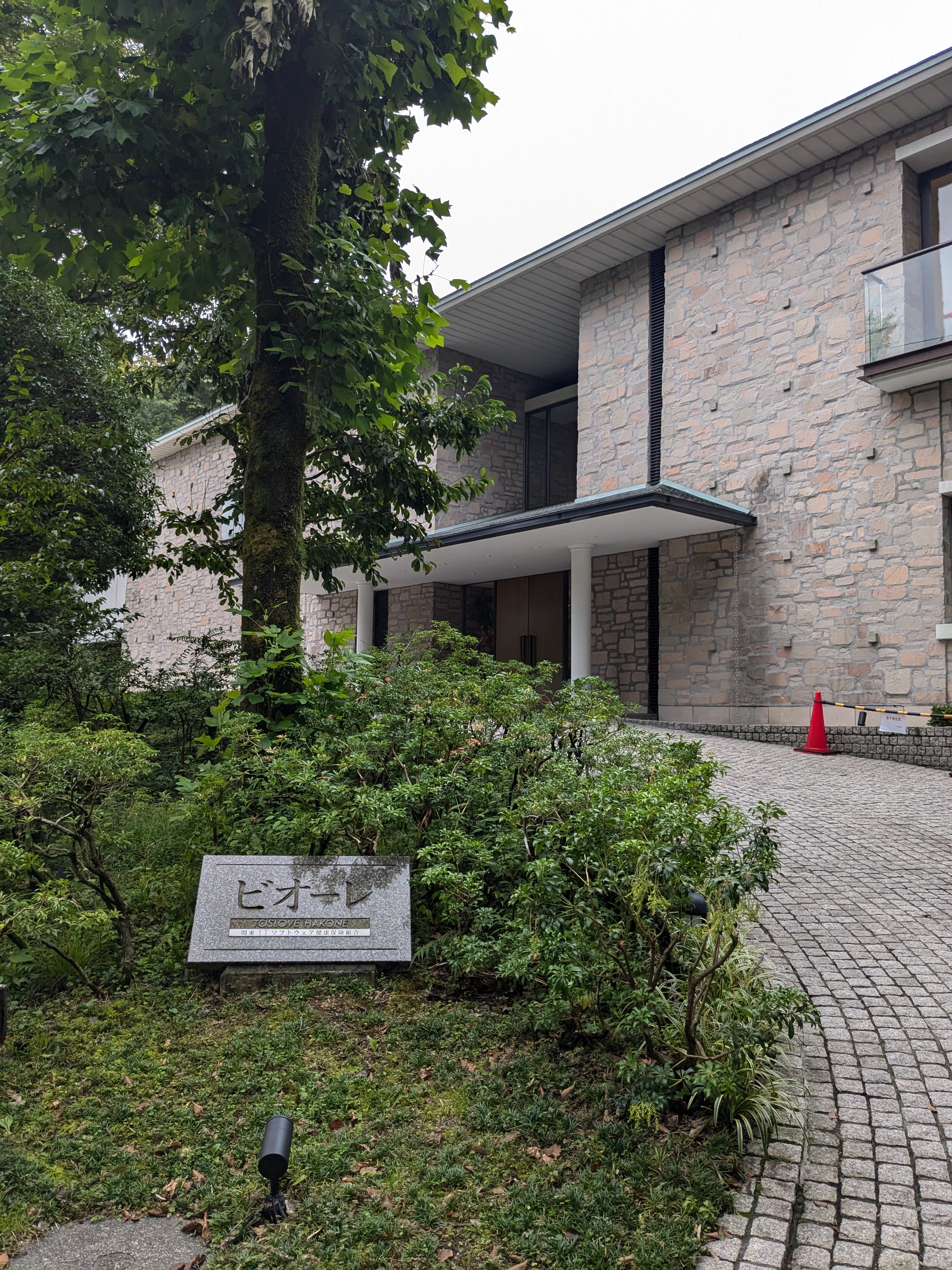 ▲ The exterior of Hotel Biore. Stone walls and green trees in harmony—a resort-style hotel
Day 1 Evening: French Dinner Course at Biore
Dinner was a French course at the hotel restaurant—five courses, completely different from the kaiseki cuisine of a traditional ryokan. “French food in Hakone?” was a slightly unexpected thought, but any meal tastes good after a three-hour hike on the Old Road—and beyond that, the quality was genuinely impressive.
The first dish was a mixed appetiser plate. On a white rectangular plate: thin slices of carpaccio with caviar, a soft-boiled egg, marinated vegetables, a meat terrine, and a slice of apple—arranged neatly. The care in the plating was apparent in every element.
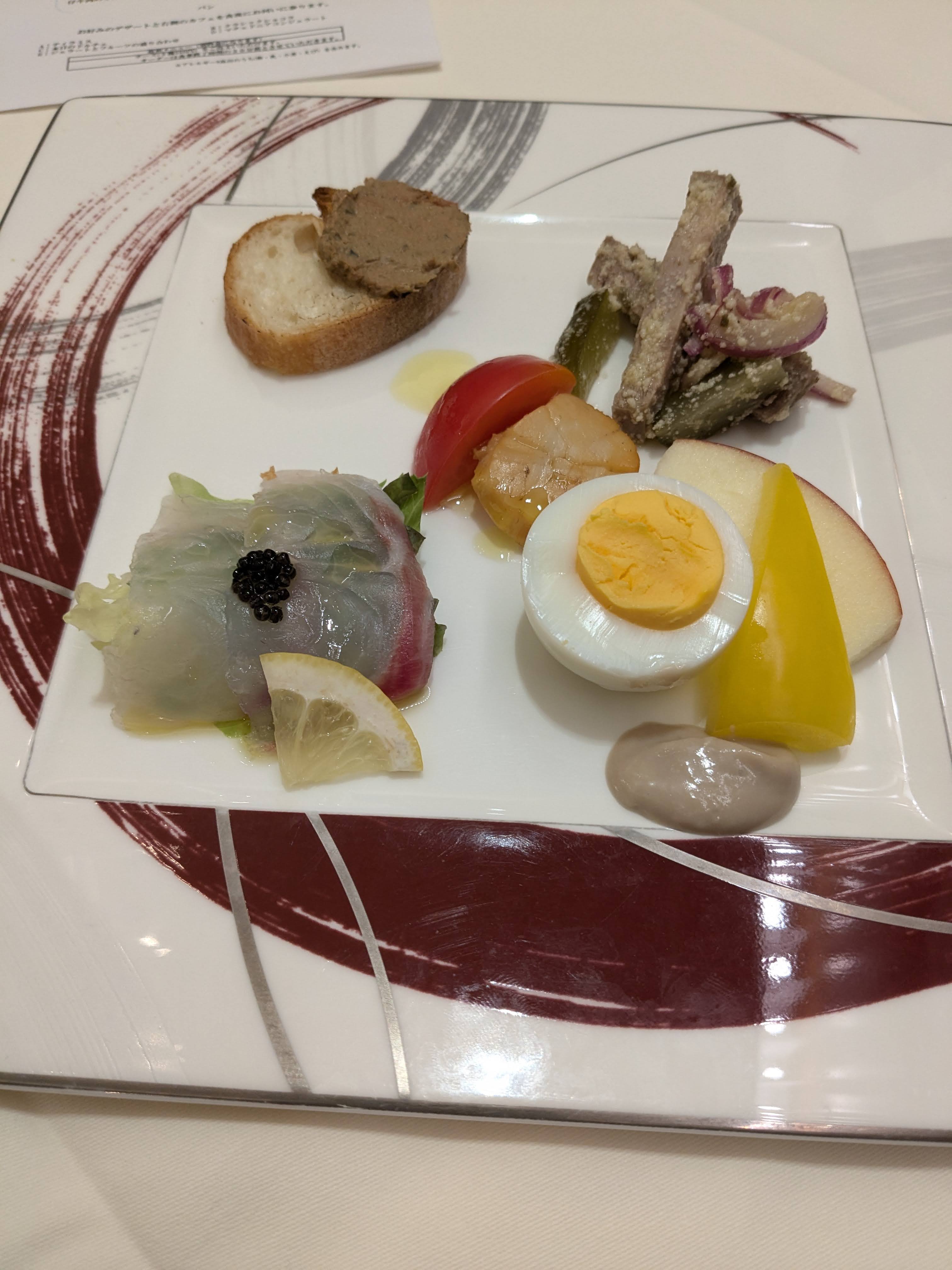 ▲ The mixed appetiser plate. Carpaccio with caviar, soft-boiled egg, terrine, and marinated vegetables are beautifully arranged on a rectangular plate
The pasta was tagliatelle (flat ribbon pasta) with meat sauce and spinach—a substantial, warming dish for the cool Hakone autumn.
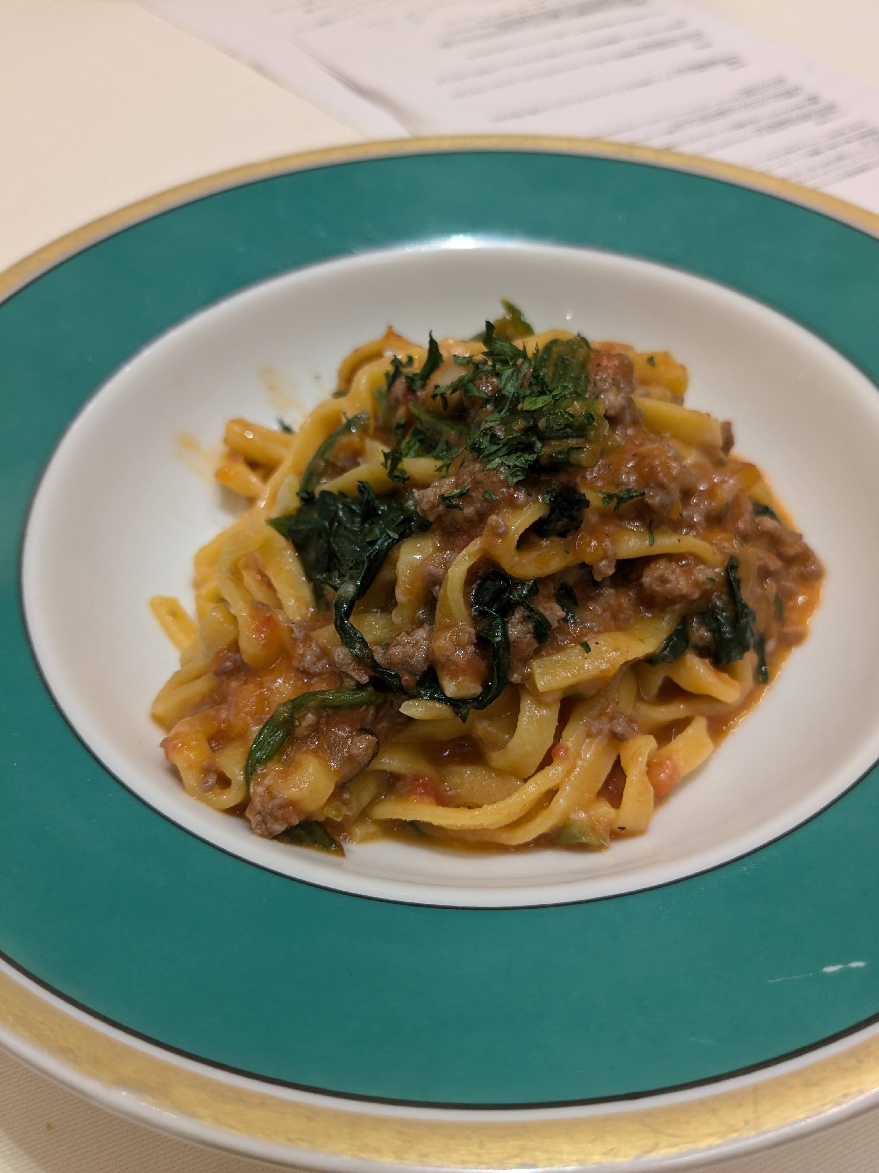 ▲ The pasta course. Flat pasta noodles with meat sauce and spinach—a hearty, filling plate
The fish course was a white-fleshed fish with an orange-coloured sauce, accompanied by what appeared to be small taro-like rounds and a bonito-flake-style garnish.
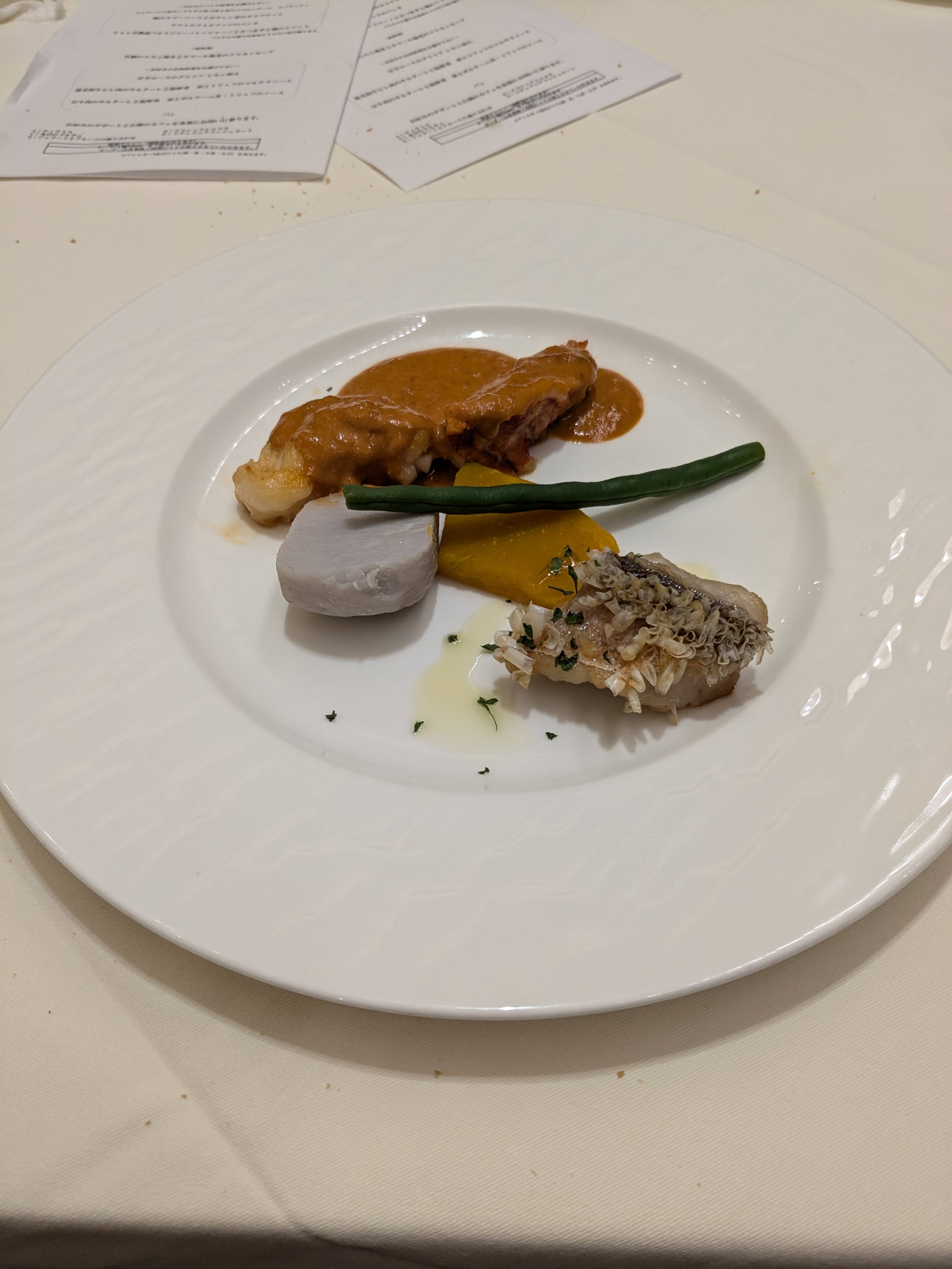 ▲ The fish course. White fish with sauce—compact in size but high in ingredient quality
The meat main—possibly pork or chicken braised in white wine vinegar—came with mushrooms and whole garlic cloves, a red wine-coloured sauce spreading across the plate. Served with mashed potato and broccoli, it was the most substantial dish of the course.
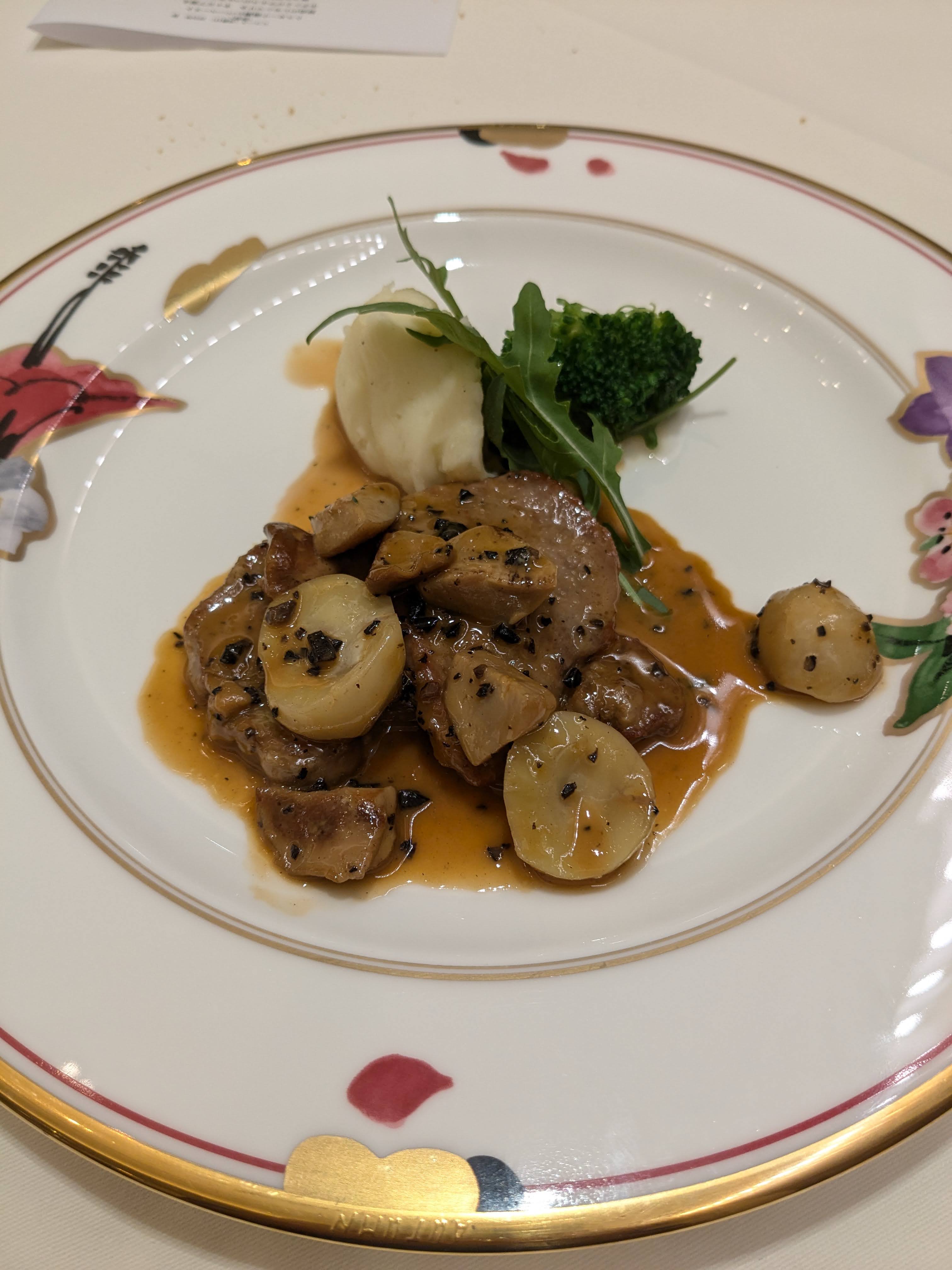 ▲ The meat main course. Braised meat with mushrooms, served with mashed potato and broccoli
Dessert brought a chocolate cake, matcha ice cream, vanilla ice cream, and fruit on one plate. As a way to close a dinner after walking the Old Road, nothing could have been better. Including the hot spring bath afterward, the feeling of “I’m so glad we came” was beyond words.
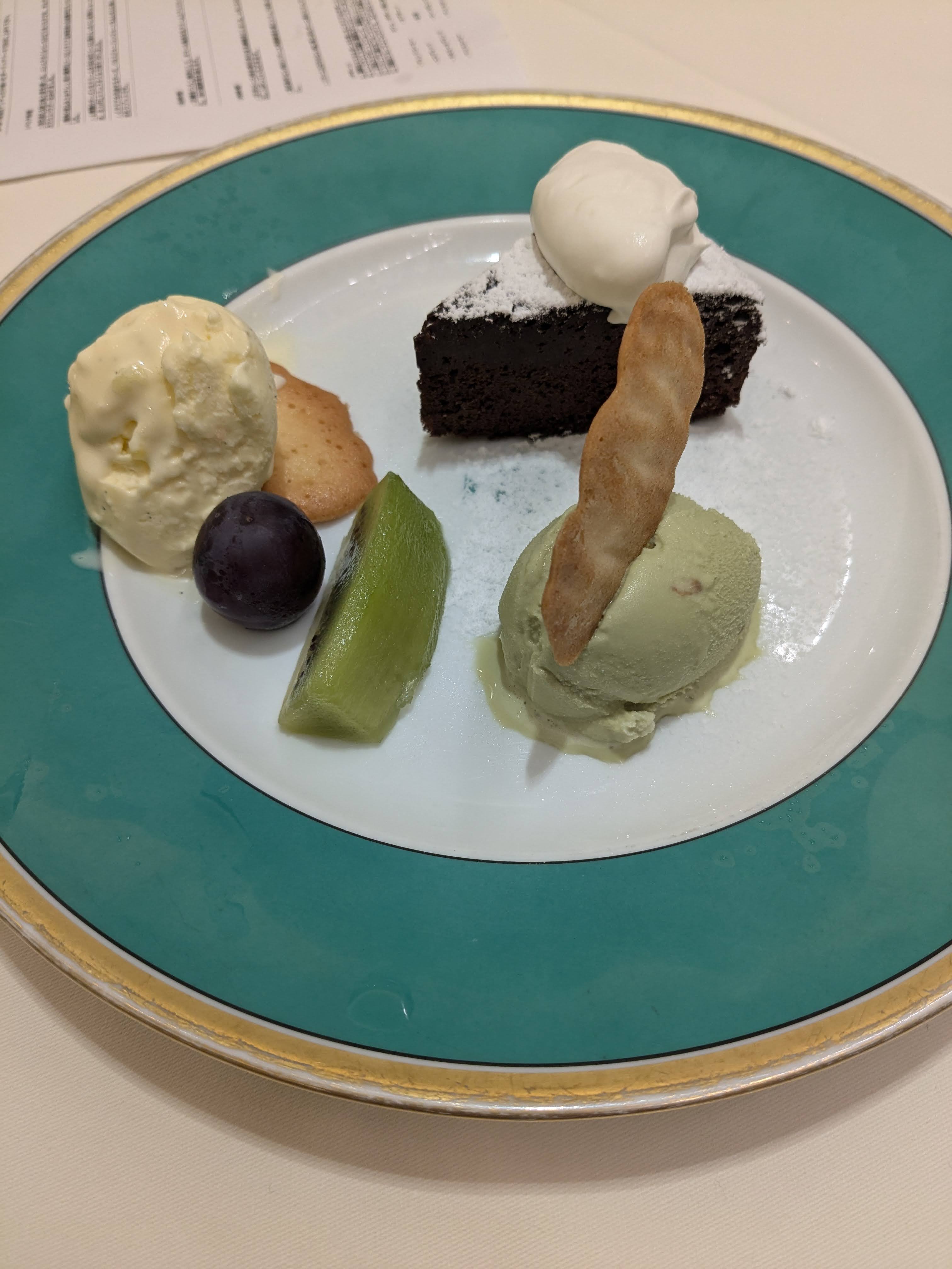 ▲ Dessert: chocolate cake, matcha ice cream, vanilla ice cream, and fruit on one plate. A satisfying close to the meal
Day 2 Morning: Hotel Breakfast Buffet
The next morning (September 28), breakfast at the restaurant buffet: a plate of sausage and poached egg, croissant and corn soup, salad and fruit. Simple choices, but well-balanced in quantity, and we ate slowly while looking out at the greenery.
 ▲ The breakfast table at the hotel buffet: corn soup, croissant, salad, fruit juice
 ▲ The main breakfast plate: poached egg, two sausages, broccoli, and potatoes—a classic morning set
After check-out, a short walk around the area, then the bus back toward Odawara. On the way home, we stopped for a cold draft beer.
Three hours on the stone road in the morning, a French dinner, a soak in the hot spring, a relaxed breakfast to close—this one-night trip was dense with experience. What started as a simple impulse—“let’s go to an onsen”—was lifted into something more memorable by the unexpected main event of the Old Road hike.
 ▲ A cold draft beer at a stop on the way home. A fitting way to end the trip
Summary
| Item | Details |
|---|---|
| Trip dates | September 27–28, 2024 (1 night, 2 days) |
| Hiking route | Hatajuku → Hakone Old Road → Motohakone, approx. 3 hrs |
| Accommodation | Hotel Biore (Motohakone area) |
| Room + 2 meals | Approx. ¥28,000 (US$187) per person (French dinner included) |
| Access | Odakyu Line → Hakone Tozan Bus to Hatajuku |
| Weather | Overcast (late September, cool) |
| Best season | October–November (autumn foliage), April–May (fresh green) |
| Note | Stone pavement becomes slippery after rain. Trekking shoes strongly recommended |
The Old Road is the kind of place you keep meaning to visit but keep putting off. Walking it in person was far more interesting than expected—every slope has a name and a story, and reading the signs as you go dramatically increases the depth of the journey. The ropeway and pirate ship cruise are great too, but if a friend asks about Hakone in the future, I’ll be recommending the Old Road hike first.
Related Articles
- 箱根1泊2日:江戸の石畳を歩いて、ビオーレのフレンチで締める旅(日本語)
- Hakone 2-Day Guide: Model Itinerary, Costs & Free Pass Tips (English)
- Mt. Oyama Hiking Trip Report (English)
Find Hotels & Ryokan in Hakone
PR: Contains a Rakuten Travel affiliate link.
▶ Search Hakone hotels and ryokan on Rakuten Travel
